- Home
-

- Across the Alps: Field Testing an Automated Light Perception System (ALPS)
Across the Alps: Field Testing an Automated Light Perception System (ALPS)
— Across the Alps —
Field Testing an Automated Light Perception System (ALPS)
Over the past half century, it has become widely appreciated that fatigue of the peripheral and central nervous system are not the same. Therefore, when one fails to perform a voluntary movement, it raises the question, was it due to the body or the brain?
Mental acuity is an important aspect of remaining performant in extreme environments. Assessing central nervous system function before and during exposure may help pace subjects while reducing the likelihood of accidents due to reduced cognition. Attempts to make such measurements in the field have been futile, as they either require prohibitively elaborate equipment or rely on subjective assessments that are not easily adapted for daily use. To address this need, I developed an Automated Light Perception System (ALPS) that aims to deliver quantified, objective, real-time feedback regarding central nervous system fatigue. Here is the travelogue detailing the journey.
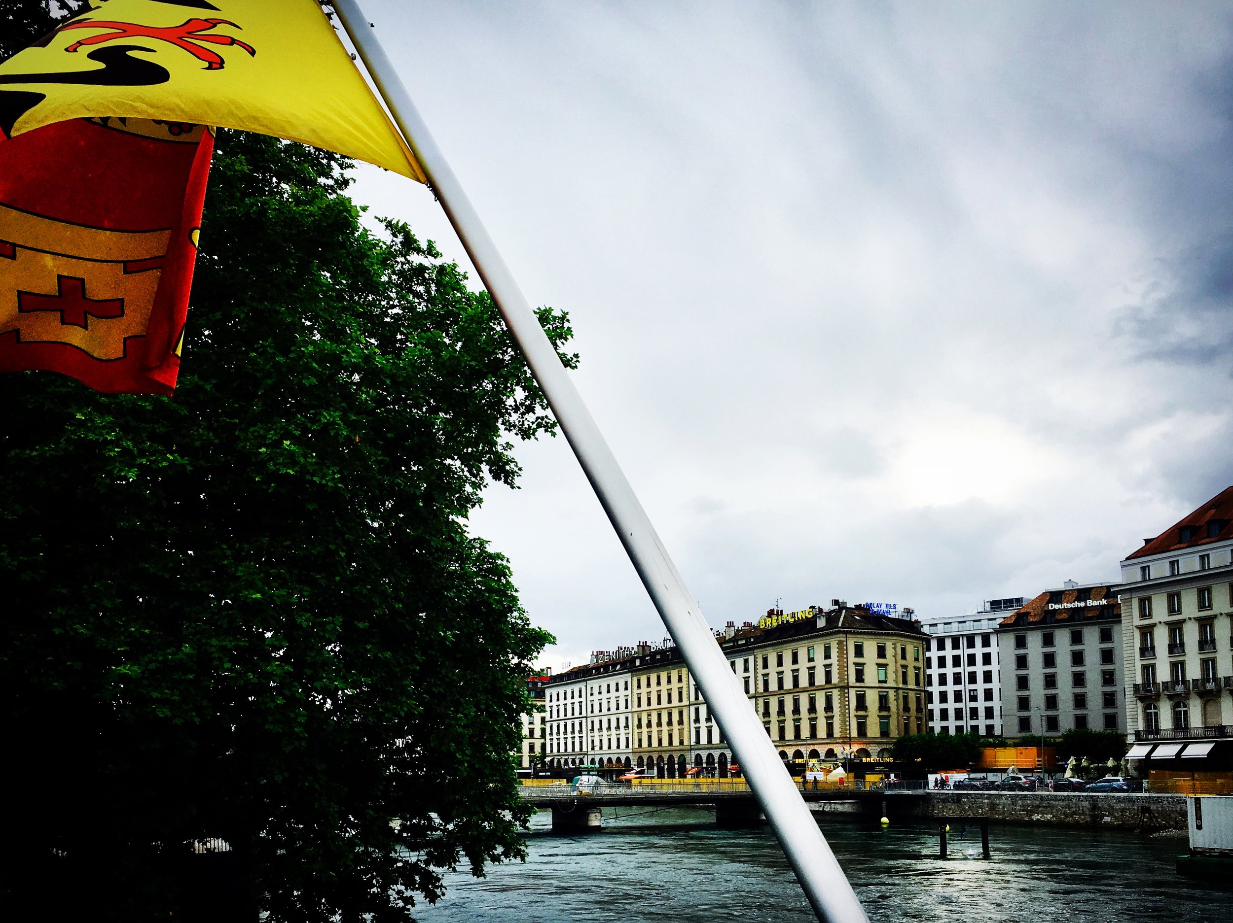
Day 1, Jun 30: Lac Léman – Lac de Genève
France-bound from Deutschland; riding VIP with @joenadasdi.. in the smelliest bus a traveler has ever smelt 😉
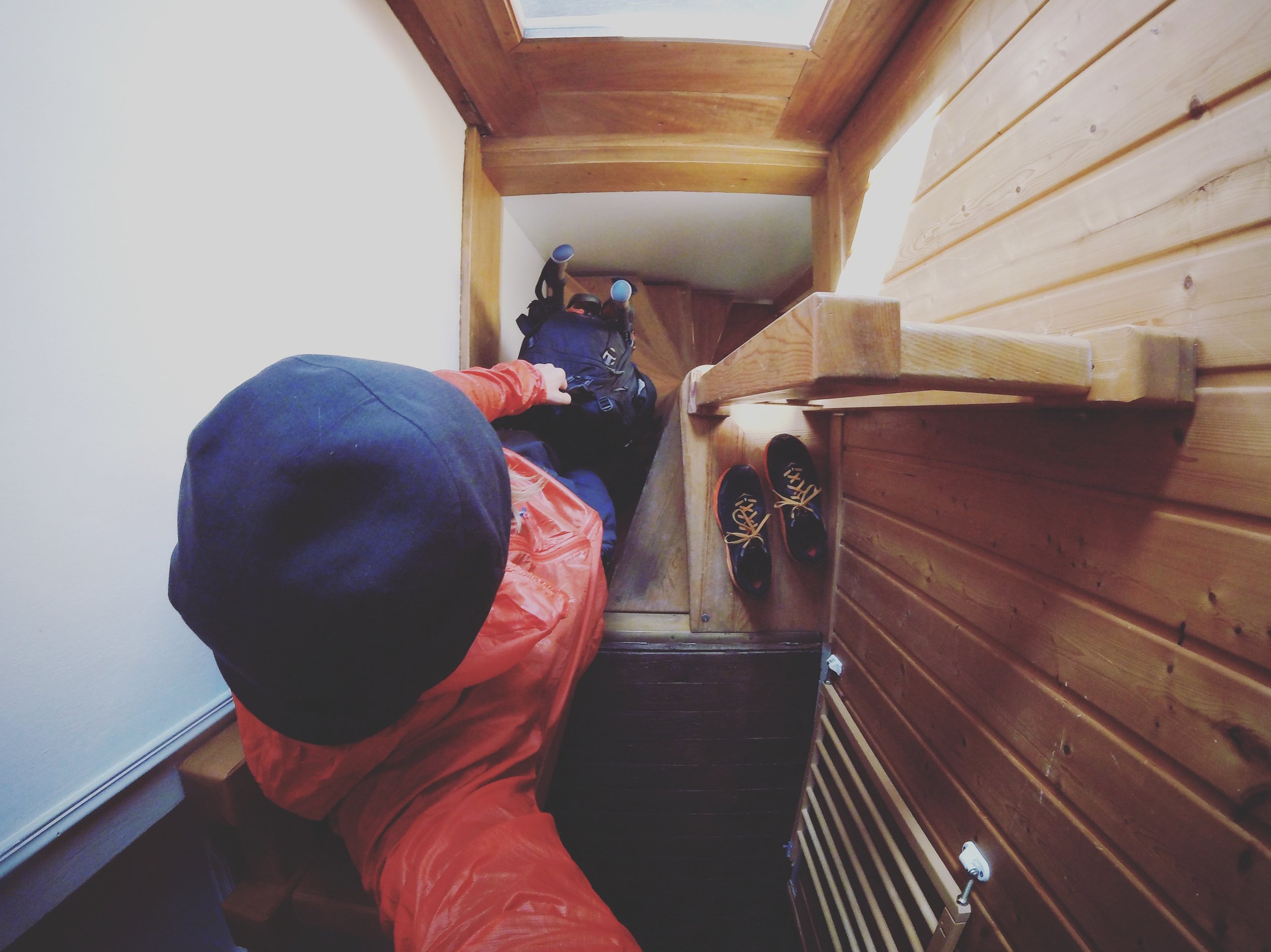
Day 2: Chamonix, France
In nothing short of a real life Gingerbread House, from a small room named Brevent, down the narrowest of a spiral staircase, I’ll continue to search for methods to better understand how the brain adapts to high altitude exposure. How might we detect central fatigue before slips of body or mind? Can those principles be translated to diseased populations at sea level? Over one hundred and fifty kilometers through the Pennine Alps these photos are the process, the journey. #gobluemed
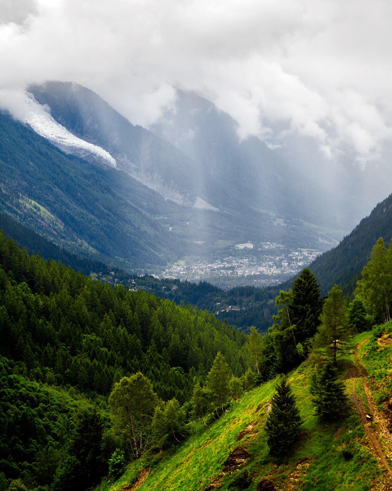
Day 2: Argentière, Rhone-Alpes, France
The rain sheets on Chamonix; a view from over 2,000 meters down the Val de Chamonix, on approach to Col de Balme.
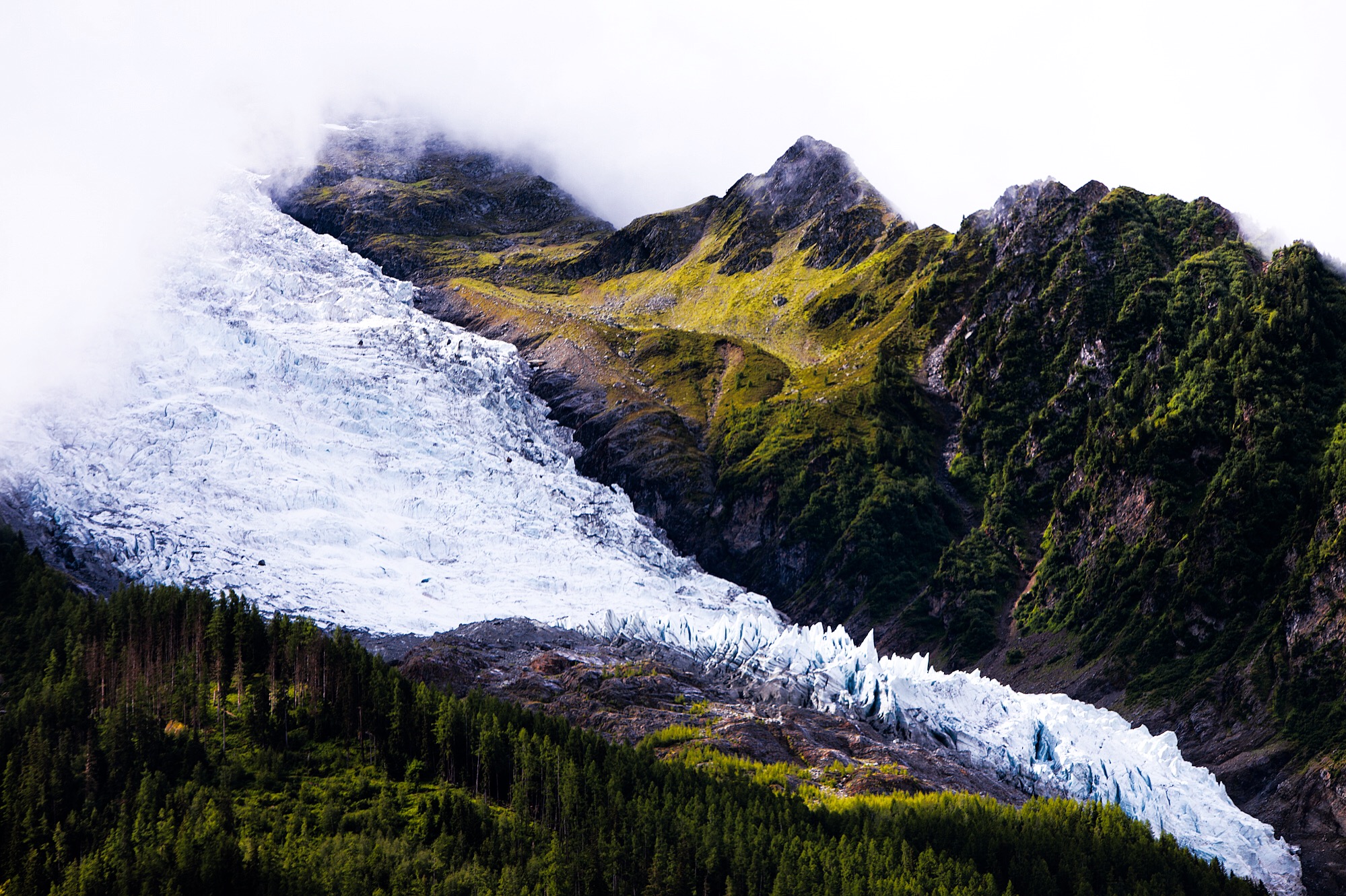
Day 2: Glacier d’Argentière
As if from the clouds Glacier d’Argentiére hugs Tour Noir. Skywards (left) Mont Dolent forms the lynchpin of Italy, France and Switzerland; upon its summit you would be tripartite.
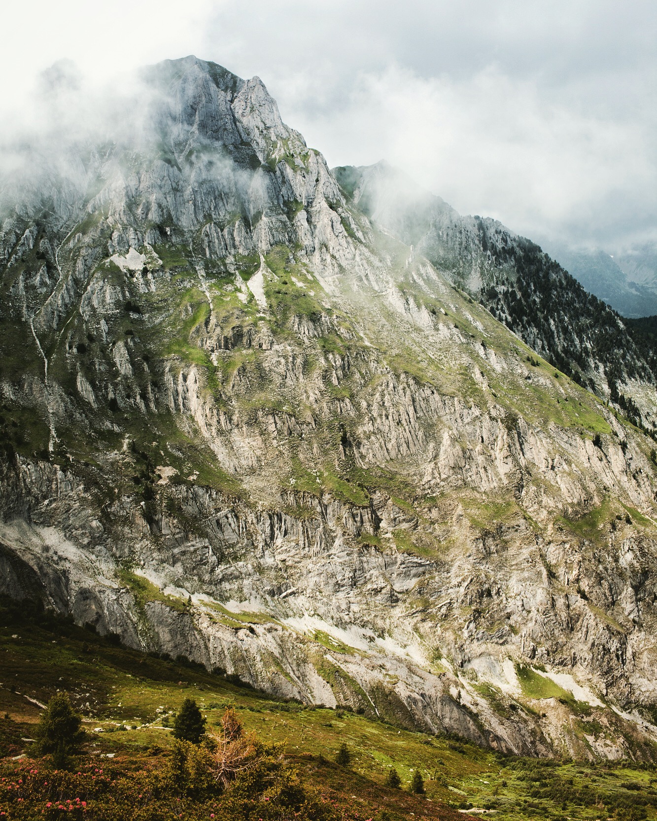
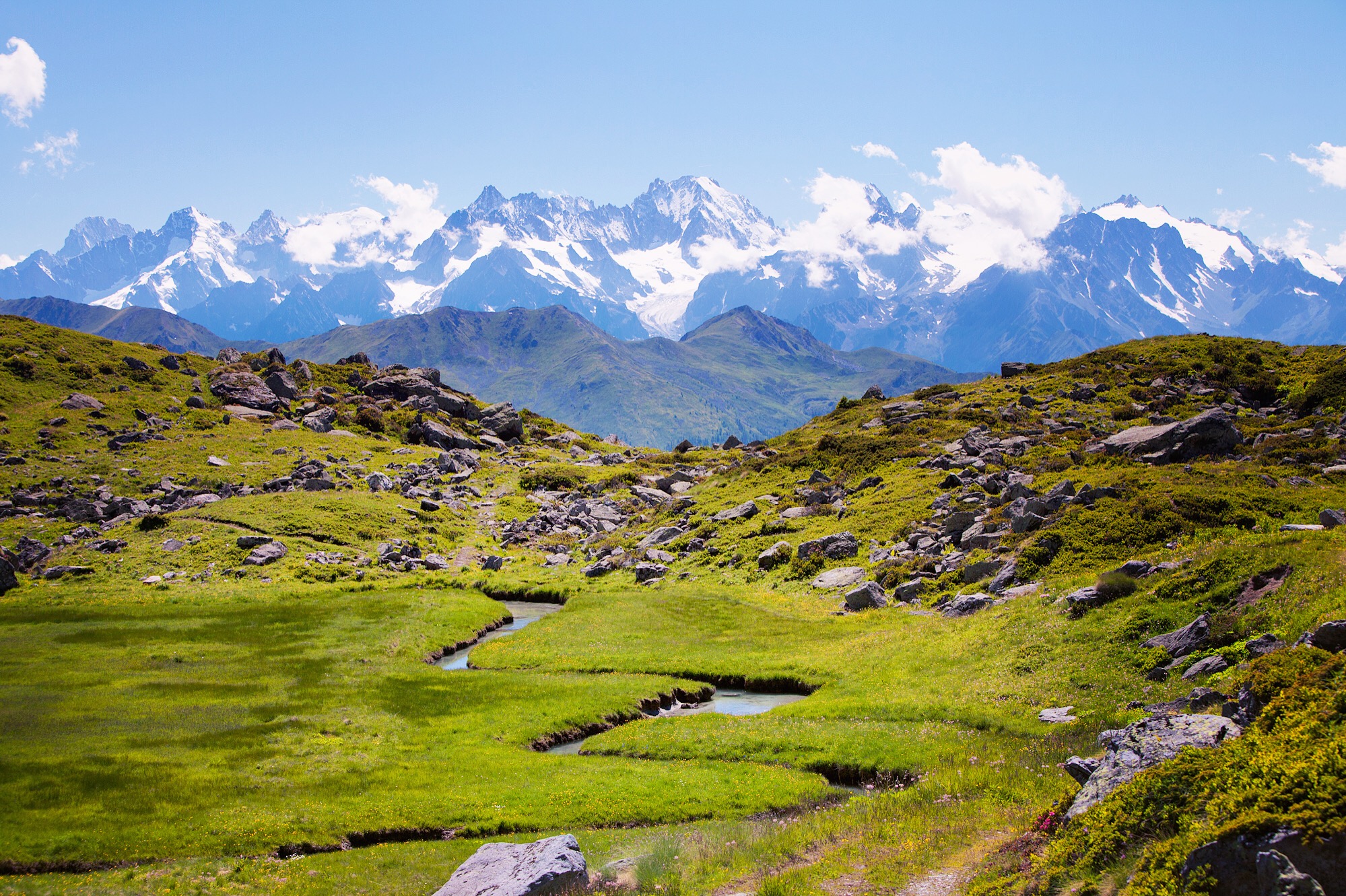
Day 2: Massif Du Mont Blanc
The Croix de Fer and Téte de Balme hide and peek, hide and peak. These mountains form the northern aspect of the massive convergence of the African, European and Asian land masses, an umbrella to the Mediterranean (ˌmedətəˈrānēən: midland; middle earth).
Day 2: Col de Balme
The first snow appears past 2,100 meters on this shale-bottomed crosswalk.
Day 2: Trient, Valais
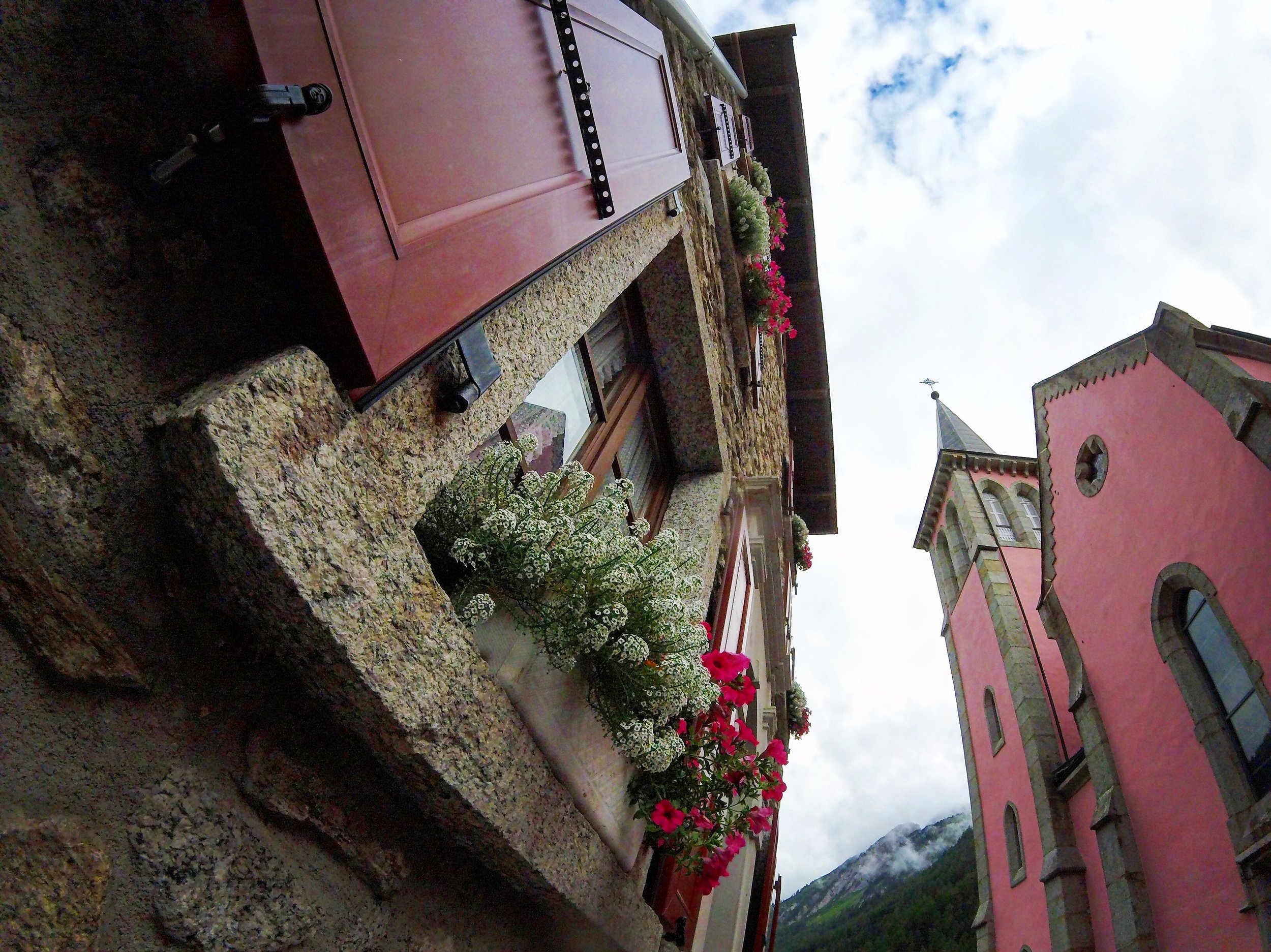
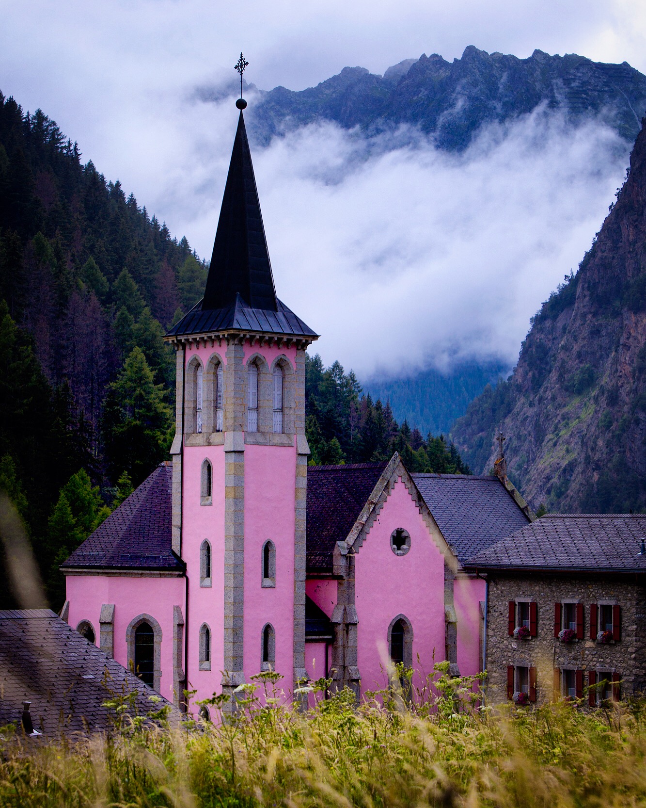
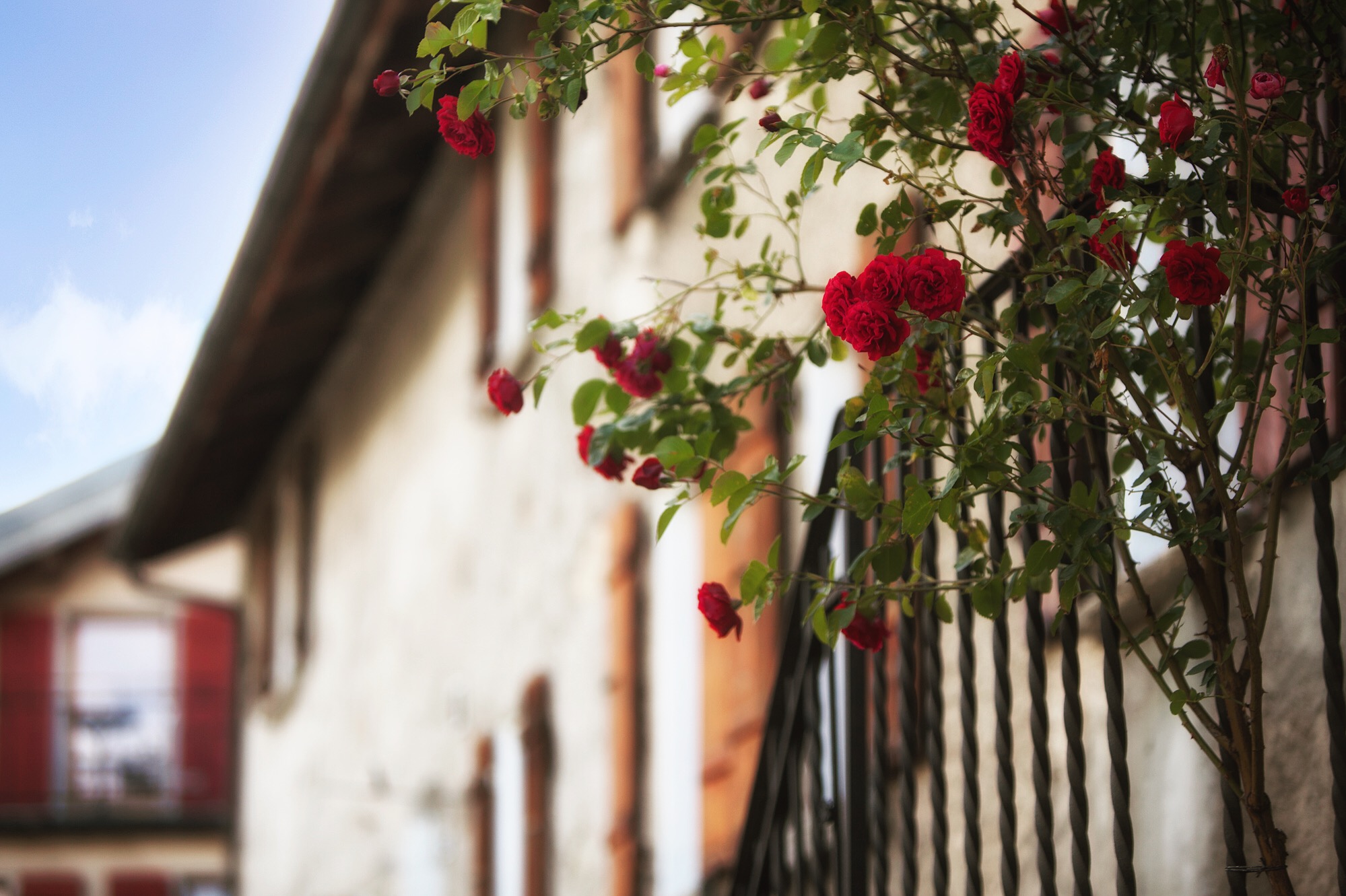
Swiss geography but French nevertheless, Trient is a most wonderful small village in a valley (Vallée du Trient). The skyline is capped by a perfectly pink chapel and rustic homes with flowers bursting open shutters of rouge.
Day 2: Trient, Valais
Truly nested…
Day 2: Trient, Valais
The descent to camp passes Route de la Forclaz, turning southern peaks into a breif history.
Day 3: Trient, Valais
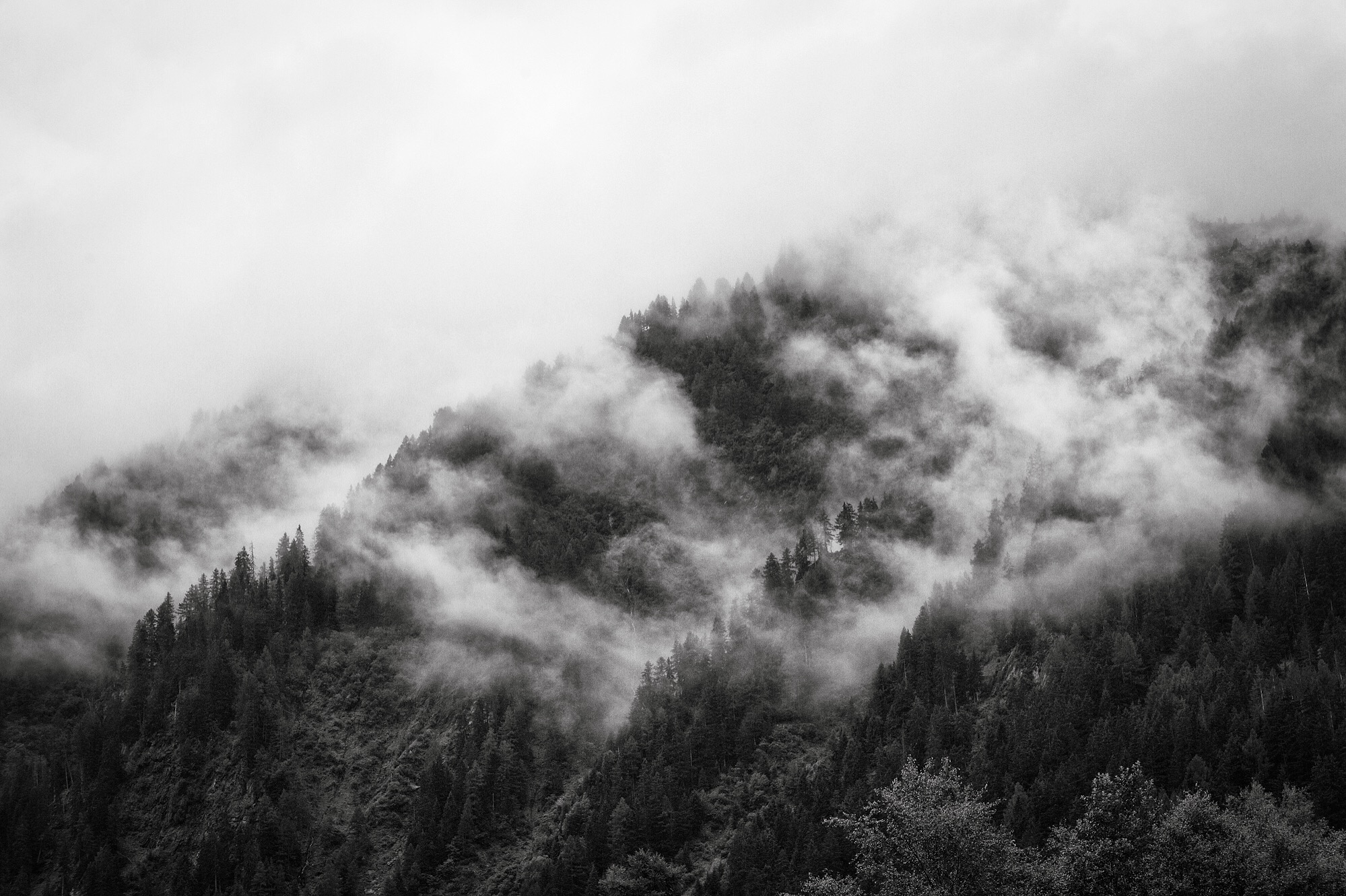
Before morning, mist pelts a bivy window and fog wanders like smoke in the hills.
Day 3: Trient, Valais
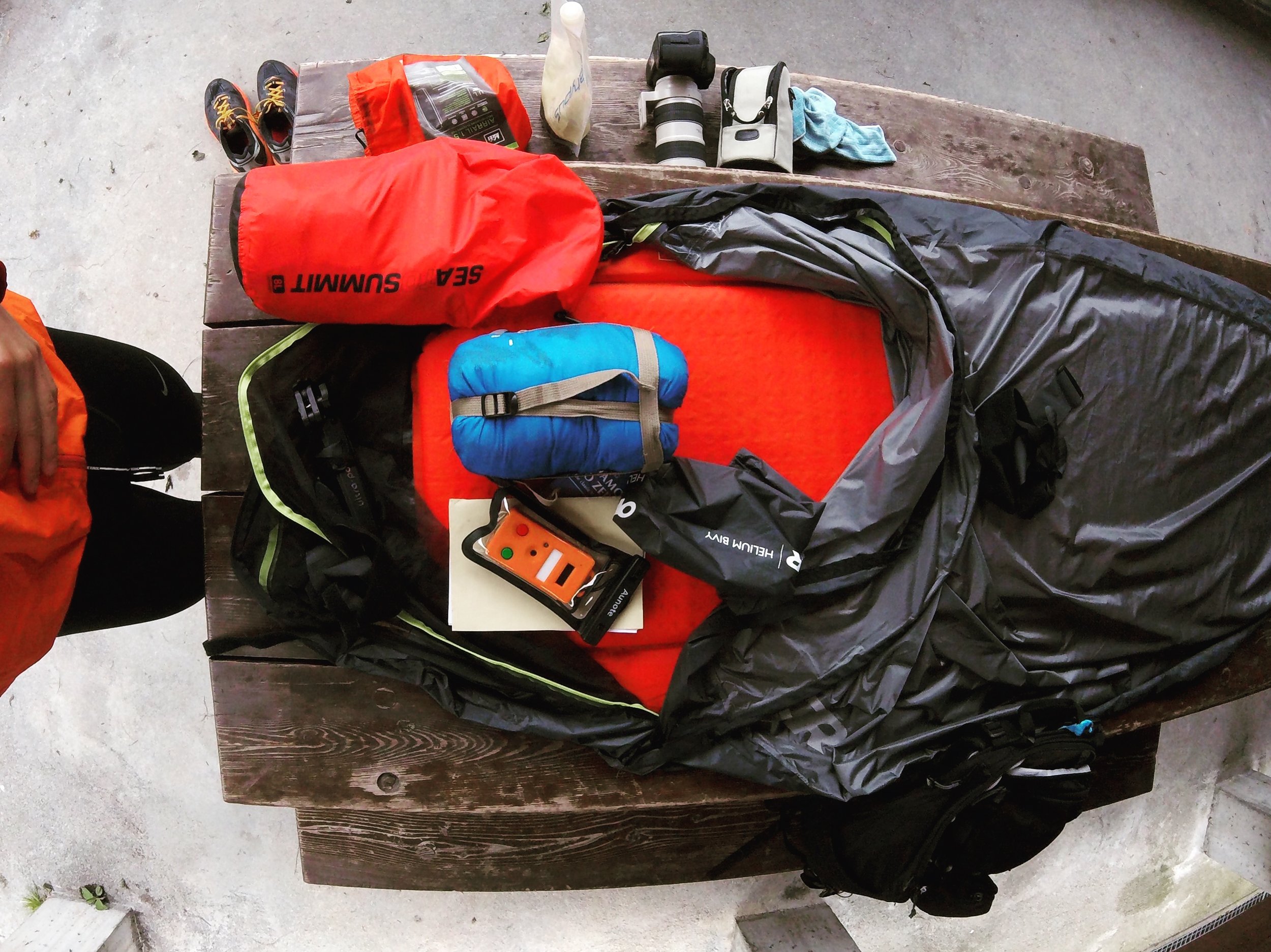
The re-pack; imperative: cold mountain water, that Nescafé shaken to a high froth.
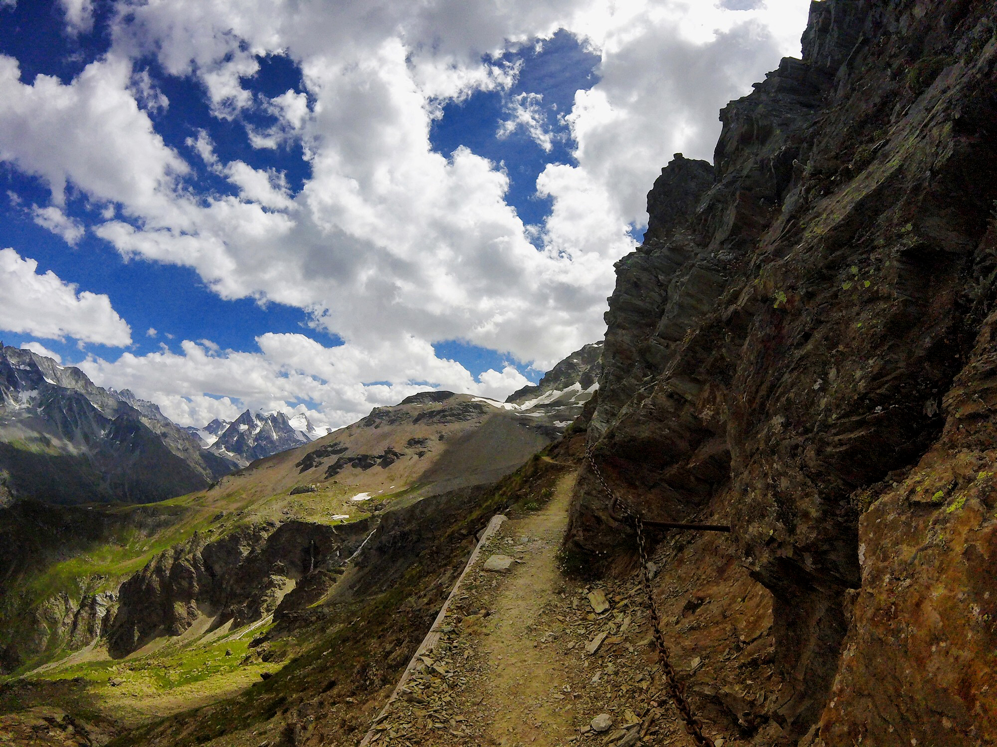
Day 3: Col de la Forclaz
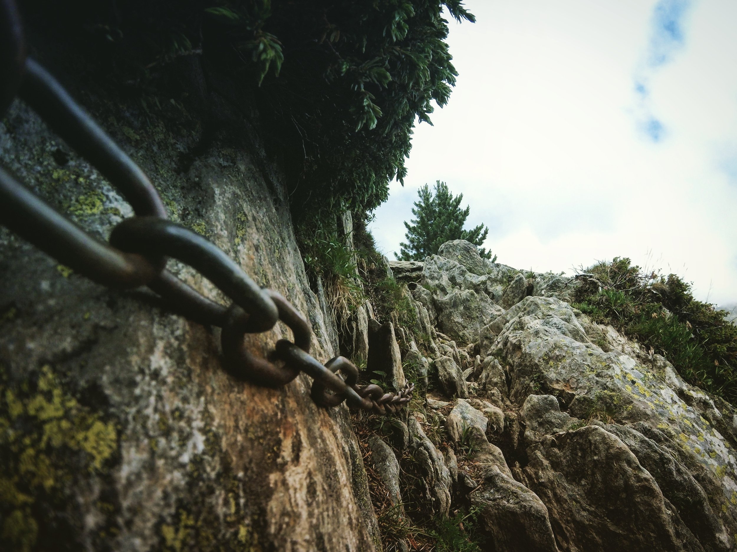
Breaks in the clouds not in the chains. The trail narrows towards Col de la Forclaz.
Day 3: Martigny, Valais
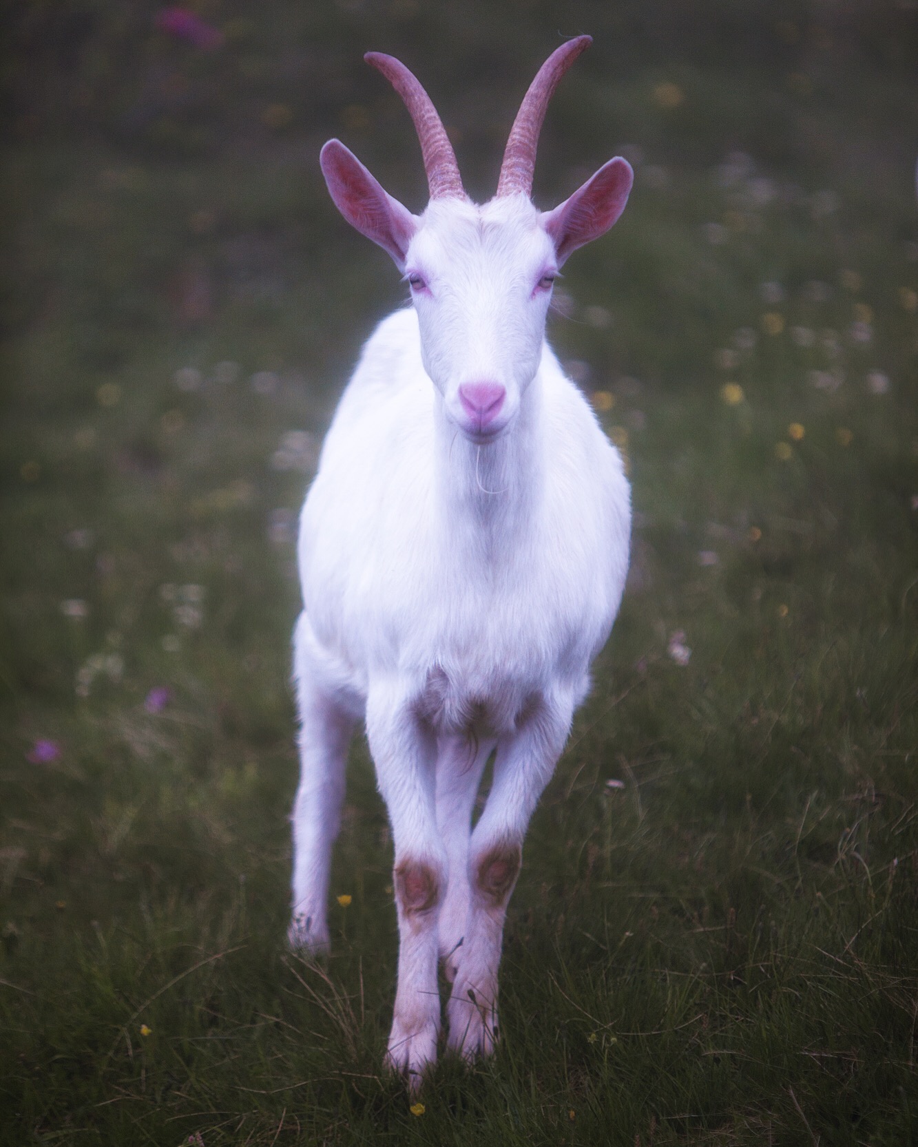
Scurrying dampened grass of the hillside, she poses for a traveler near the meadows of Alp Bovine and the Rhône valley.
Day 3: Val de Bagnes
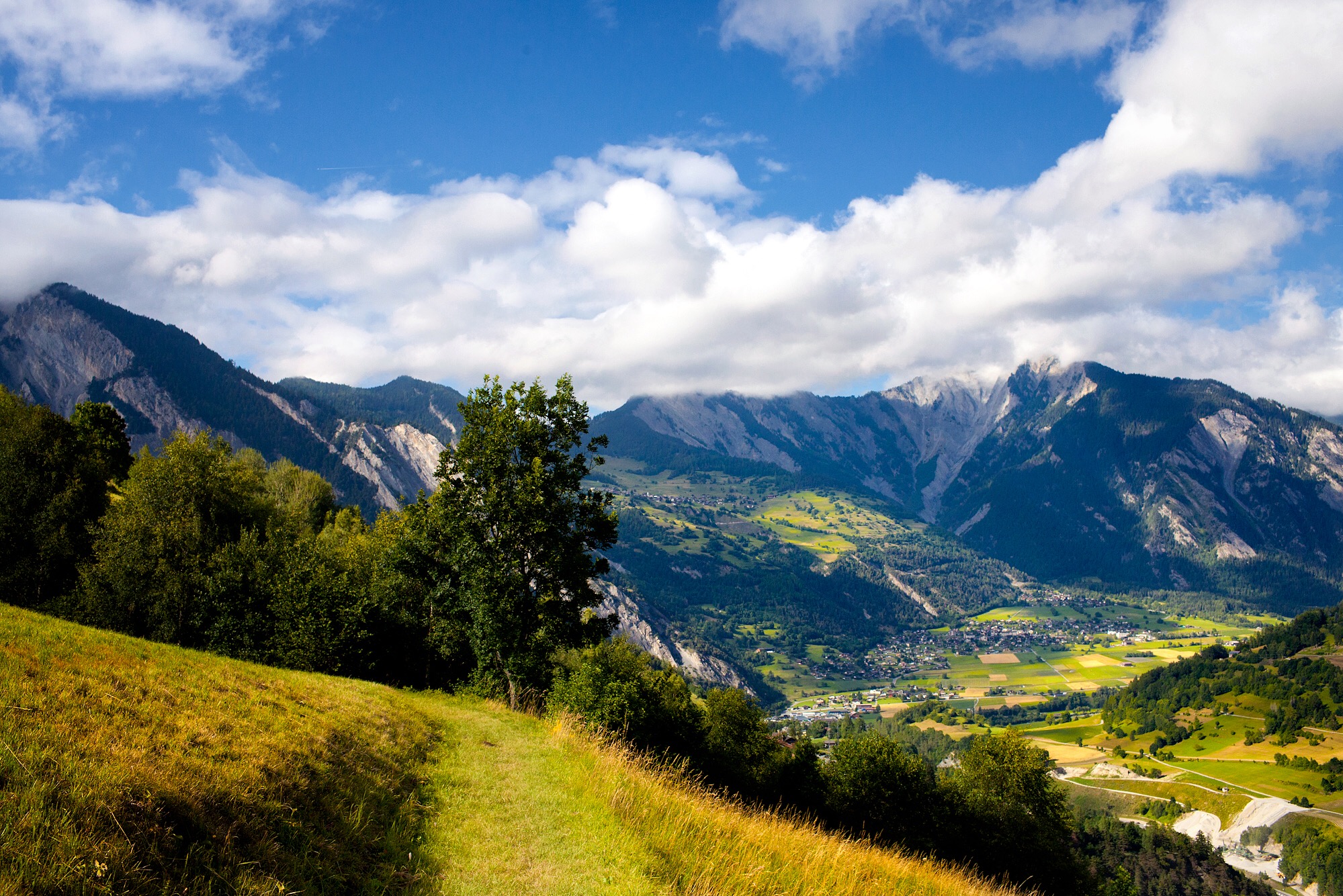
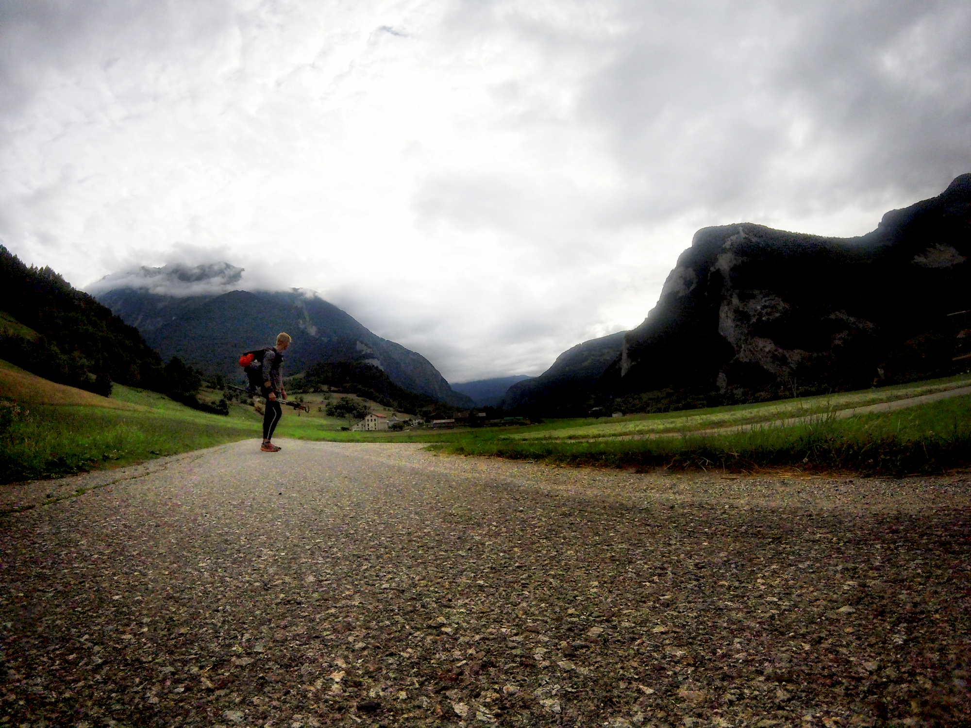
Towards Sembracher the clouds lift. High meadows roll as one village becomes the next.
Day 3: Sembrancher, Switzerland
The flowers passing Plan L’eau are endemic, enchanting. If their origin wasn’t known you might think homes harbor their roots and noses shine their sun.
Day 3: Le Châble, Valais, Switzerland
Heading north past the village of Champex, from Sambrancher to Le Châble, the pathways of the Tour du Mont Blanc are left behind. It is now only the Haute Route; white and red marks painted on a rock, scribbled to a tree.
Day 4: Cabane Mont Fort
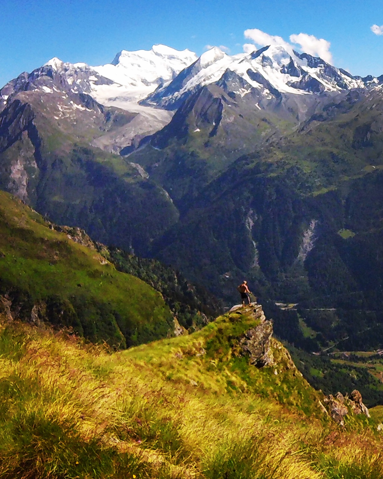
Lost circling a valley descent from Cabane du Mont Fort after taking the long way up through Verbier. The spectacular panorama of the Mont Blanc massif and winding river fed by Glacier de Tortin echoes purpose to an off-foot.
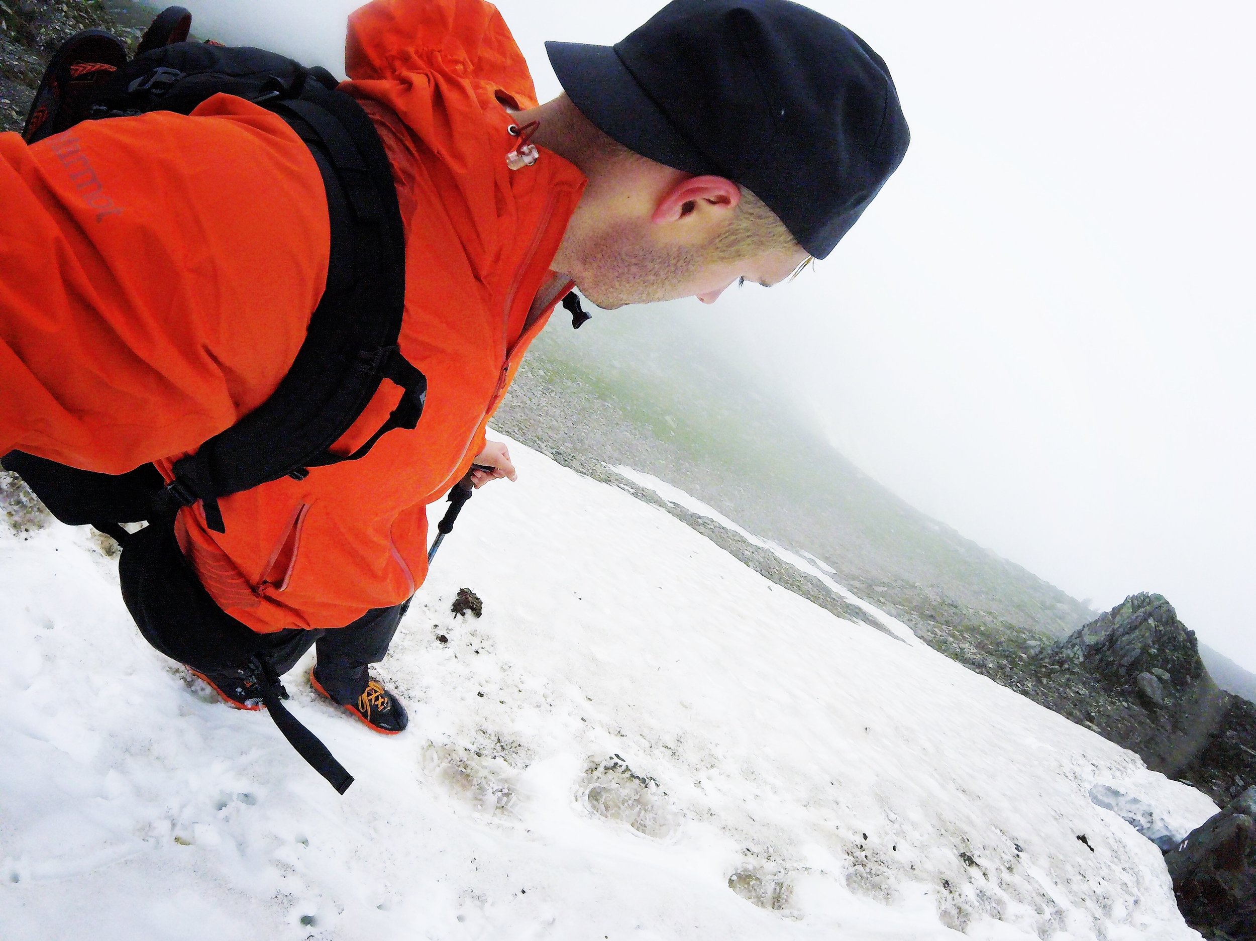
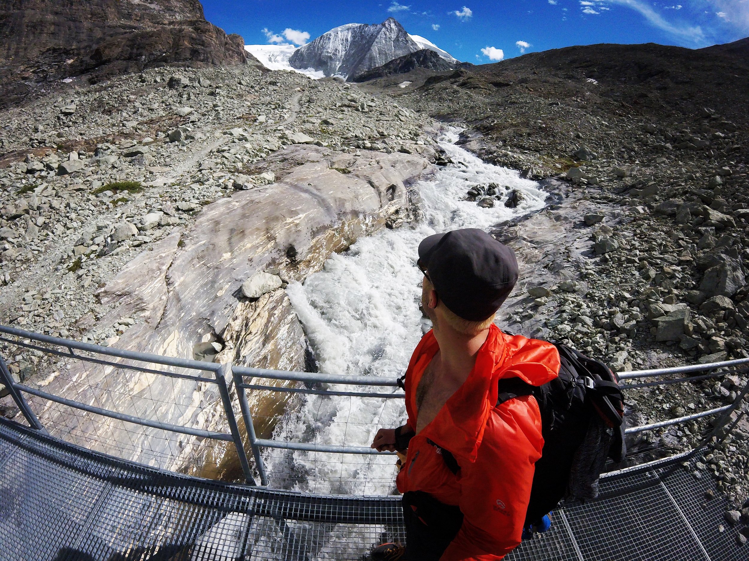
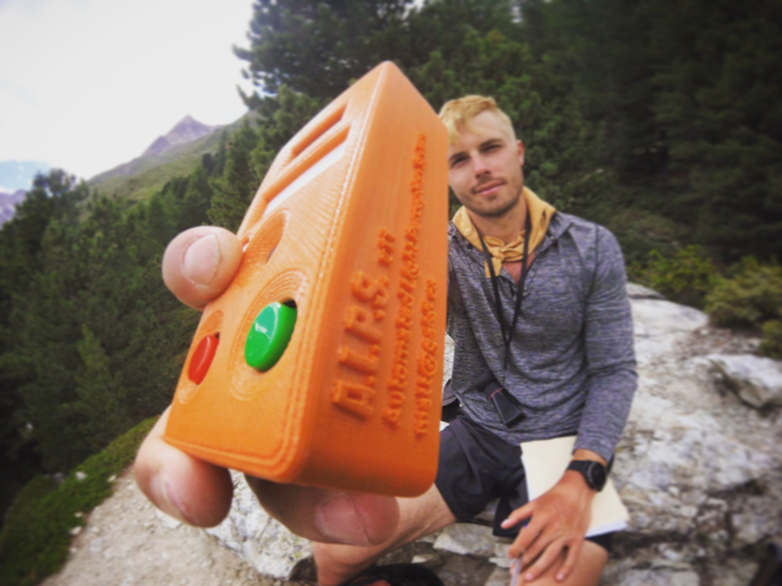
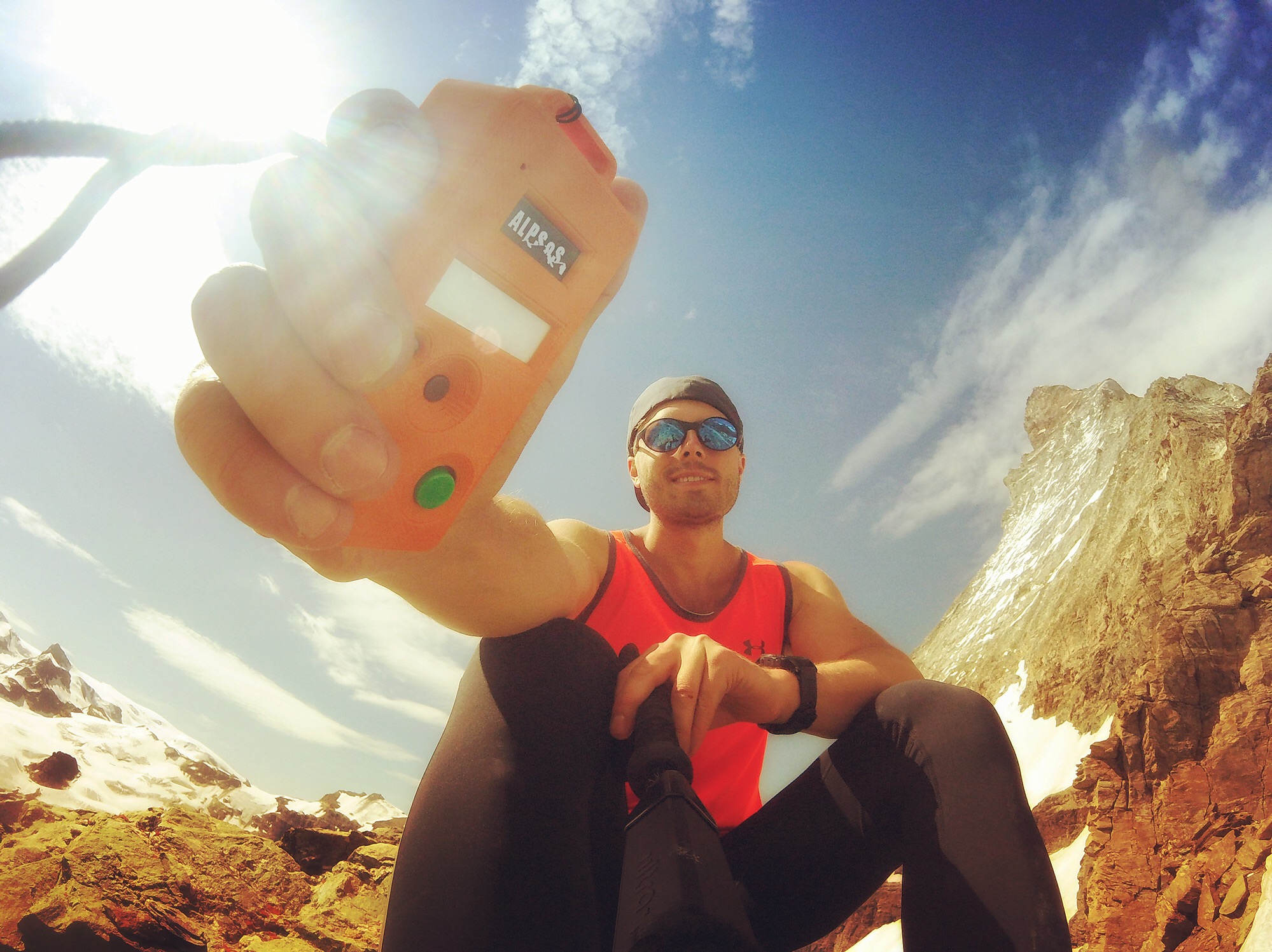
Day 4: Col de Louvie
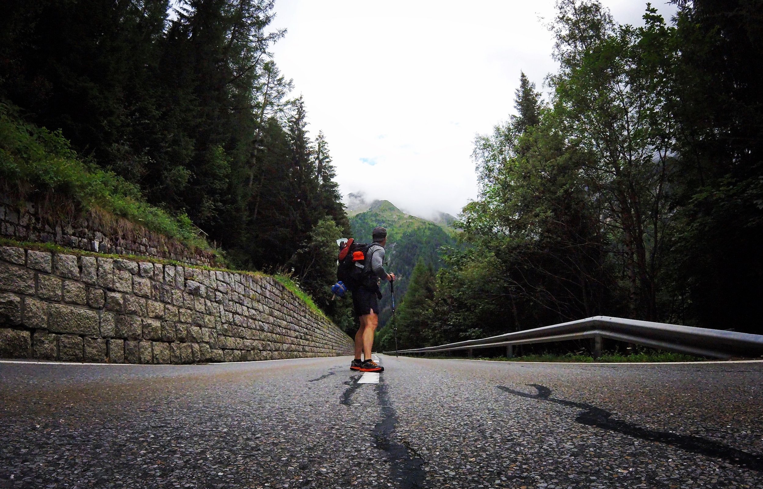
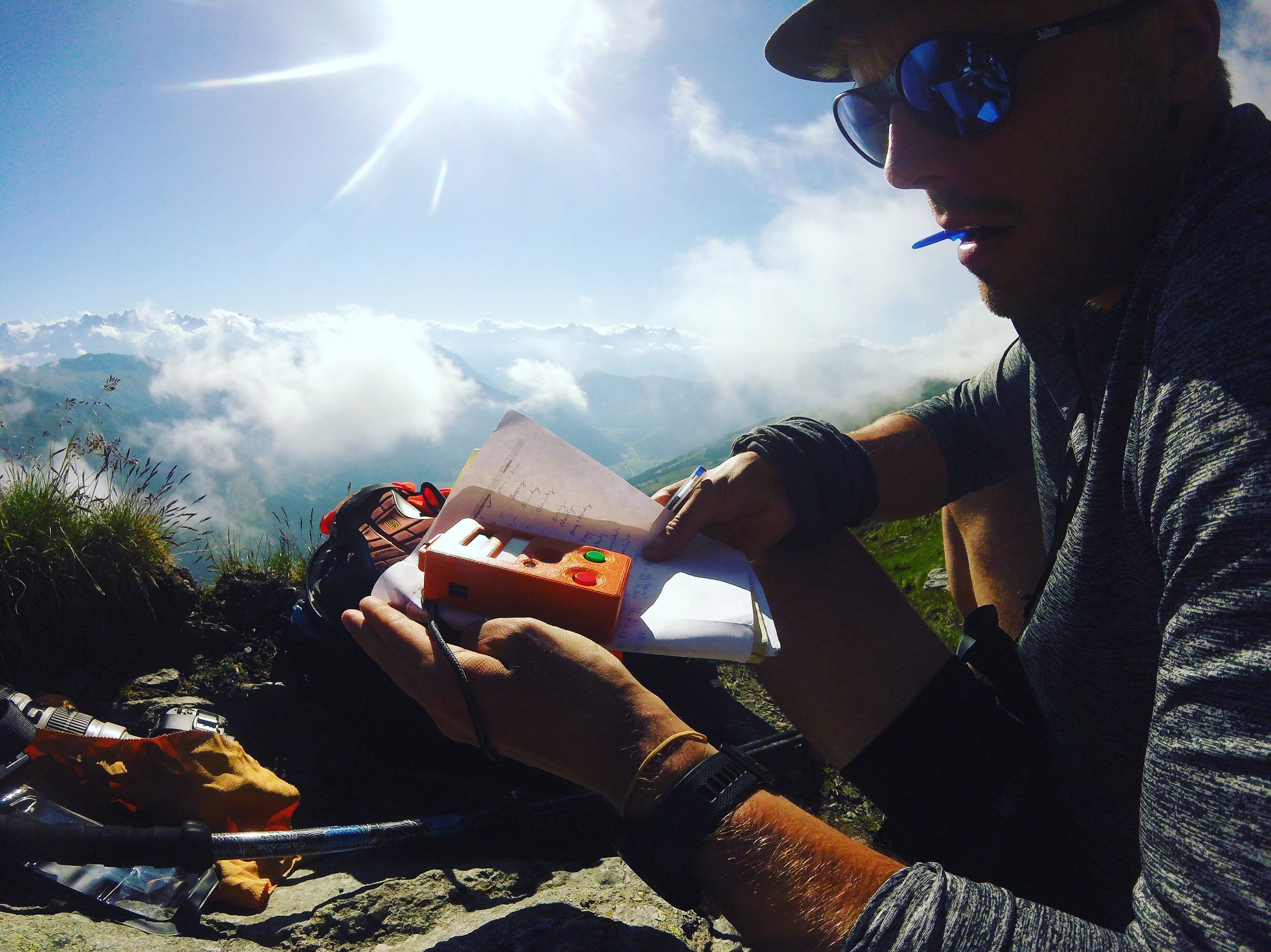
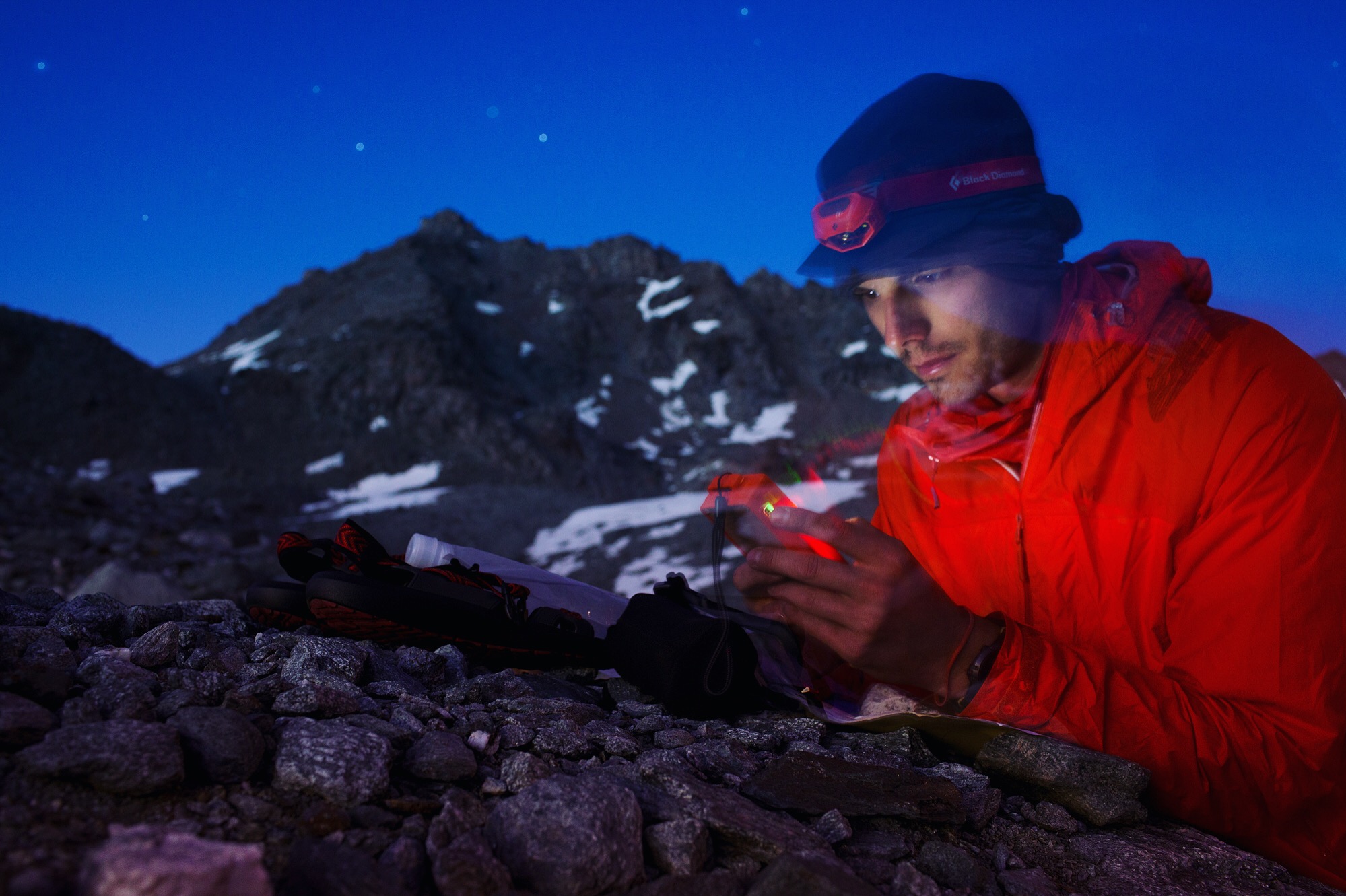
Coming to Col de Louvie at 2,921 meters it’s more testing. The device in orange is one I developed to measure critical flicker fusion threshold: the frequency at which you perceive a flashing light turn solid. It’s not the newest idea, but it has considerable support in the literature, and I don’t think it’s been done like this before; as a portable, handheld diagnostic tool. The measurement has been correlated with neurodegeneration, central fatigue, and hypoxia. I’m not here for an n-equals-one experiment, but rather, to put the method through its paces and figure out if it has a place in the mountains.
Day 4: Col Termin
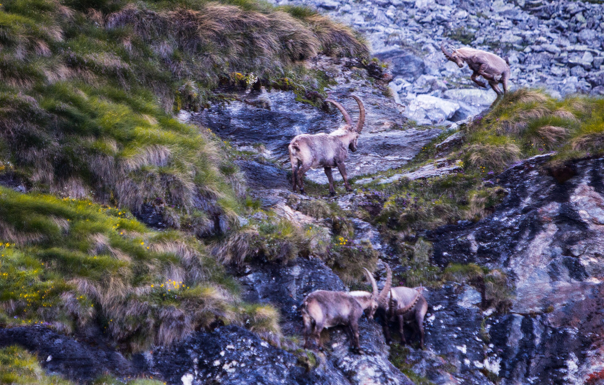
Coming down from the col I followed a path—or what I thought was one—alongside a grass-shale vert face. Before knowing my wrong, I was stuck, collapsing my poles into short spears, edging towards level ground. As rocks broke free I heard them hit the narrow path below before launching into a void high above the Grand Désert floor. Eventually returning to the main path, gripping the chain stapled to the mountain, Clank! Clam! Ahead and just above, ibex males were in full brawl, lurching high into the air and ramming their hard heads and horns at each other. Was this just a friendly match or real war? As some other ibex, smaller males and females, stood atop a perch, the alphas coursed down the rocks taking turns at each other.
Day 4: Col De Prafleuri
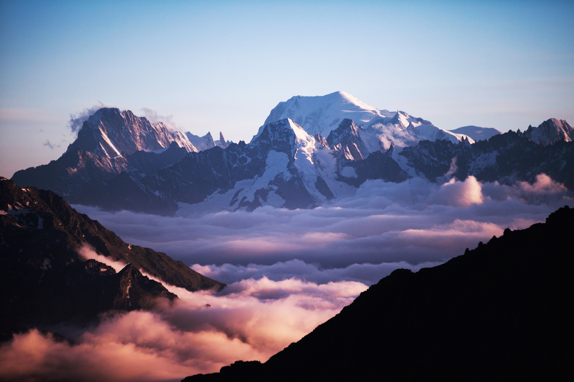
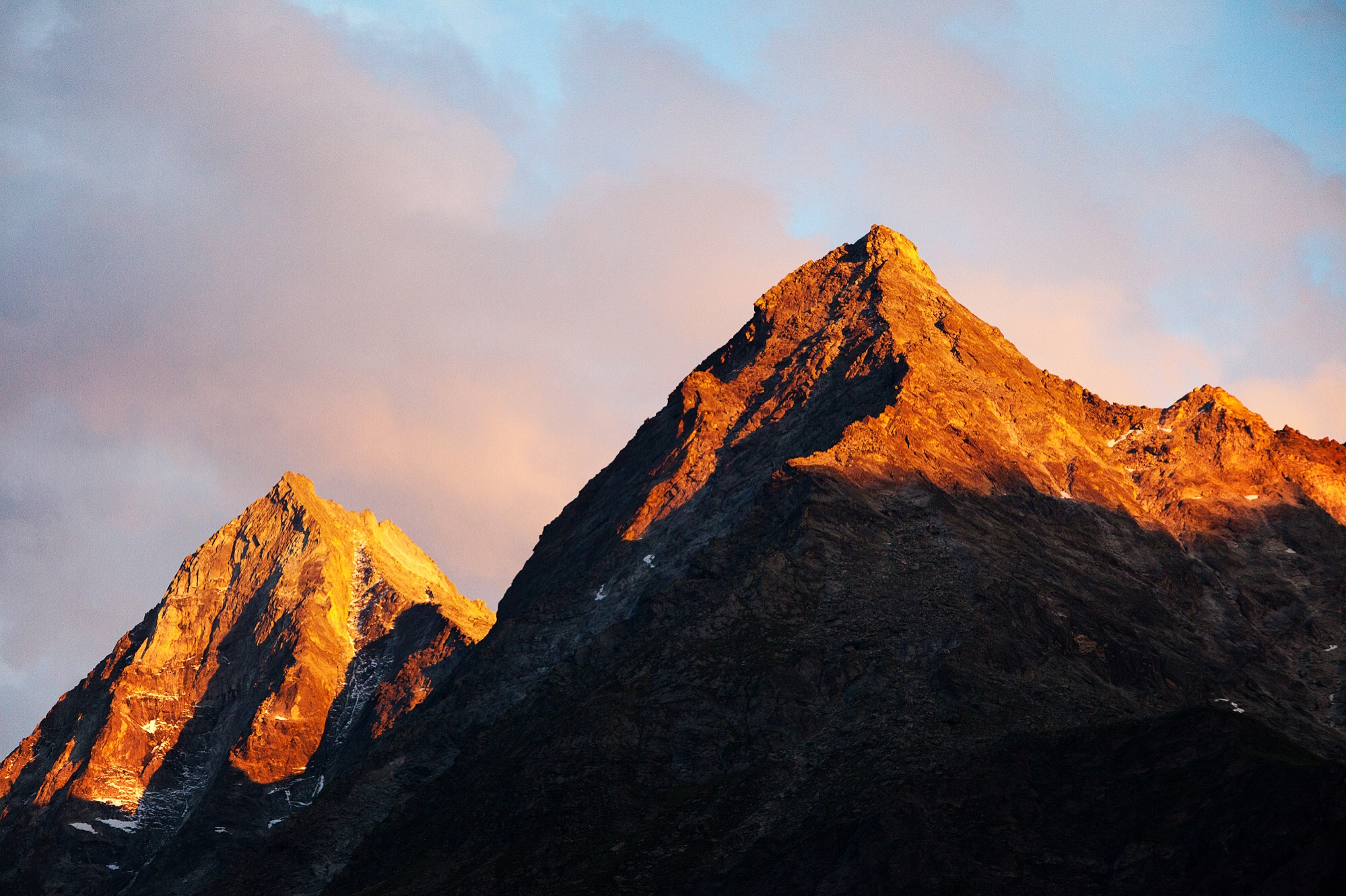
Late to Col de Prafleuri at 2,965 meters. Above the clouds the sun lit Mont Blanc and Grand Comin, purpling the clouds below. I had run the day out; a scurry down the glacier like a kid down a sandbox slide. I realized this must be home for the night, trapped by dusk above and boulder fields at each earthly end.
Day 4: Lac du Grand Désert
One more test greets the face of a many distant suns.
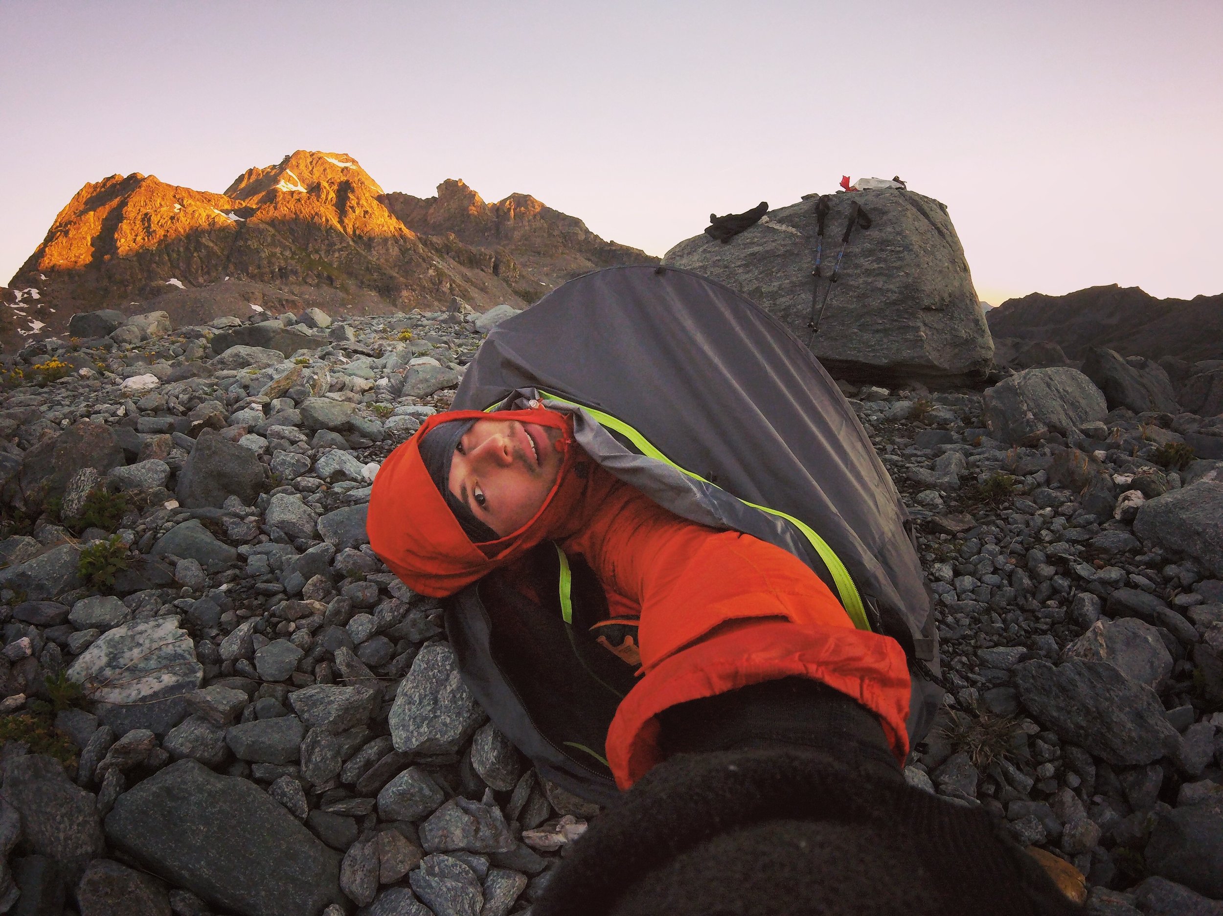
Day 5: Lac du Grand Désert
6:14 AM It was the gravel bed of a mountain desert lake. To my head was the Grand Désert Glacier and to my feet the lakes of its runoff. Never did I understand the worship of Apollo so well until the sun removed that ghastly, cold shadow of night. cc @outdoorresearch #helium
![Day 5: Col de RouxBetween the desert and Col des Roux was isolation. I wondered if that was the furthest from human beings I've ever been. We are notoriously tribal; from birth surrounded by one to[o] many people. What is the furthest from othe…](https://images.squarespace-cdn.com/content/v1/5632dd3ee4b0c1d58a555ac6/1500420879897-SXSW4BTPX5KCV7DSNTNV/image-asset.jpeg)
Day 5: Col de Roux
Between the desert and Col des Roux was isolation. I wondered if that was the furthest from human beings I’ve ever been. We are notoriously tribal; from birth surrounded by one to[o] many people. What is the furthest from others you have ever been? How comfortable were you in those moments? Our busy-ness may be our plague, and our insurances and silks softening us to the core. We fear consequence of others and the 21st, not until the scare of wild have those disintegrated for my self. Or we have, figured it all out…
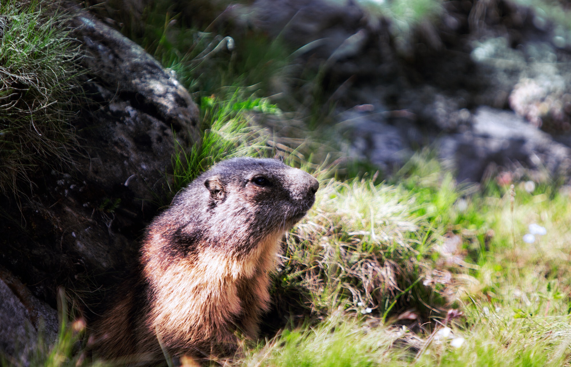
Day 5: Lac des Dix
The beavers and gophers from Michigan need to talk to whoever does the PR for the Swiss marmot. Revered nearly to the extent of the ibex, these prairie animals tunnel the grasslands from one end of the Alps to the other. I’m calling hype on this waddling mountain rat.
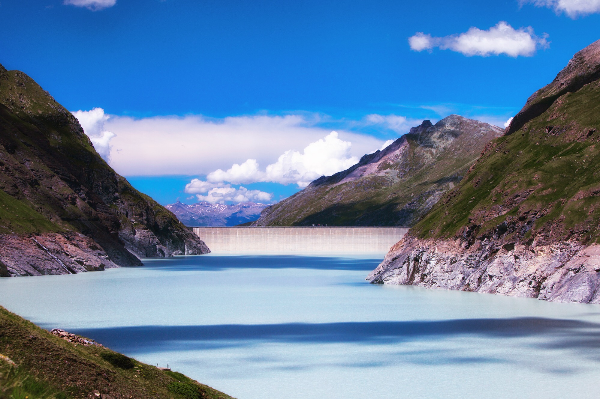
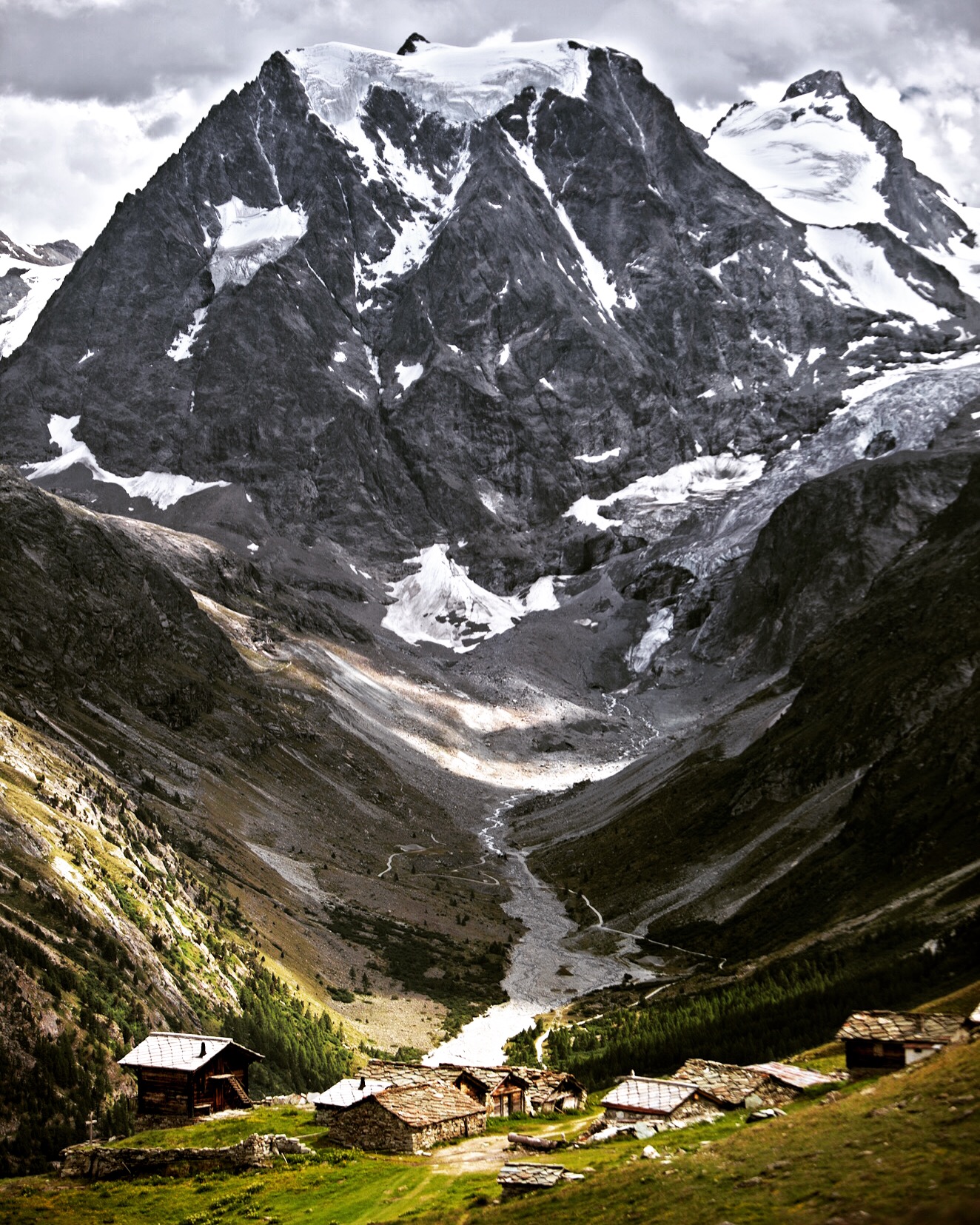
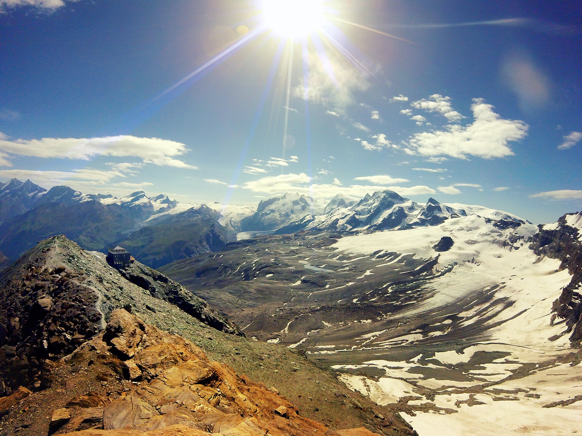
Day 5: Grande Dixence Dam
Edging towards Mont Blanc de Cheilon, Lac des Dix engulfs four square kilometers of land at an altitude of 2,364 meters, forted by Grande Dixence Dam at its end. The clouds lay shadows onto the earthy turquoise Glacier runoff.
Day 5: Mont Blanc de Cheilon
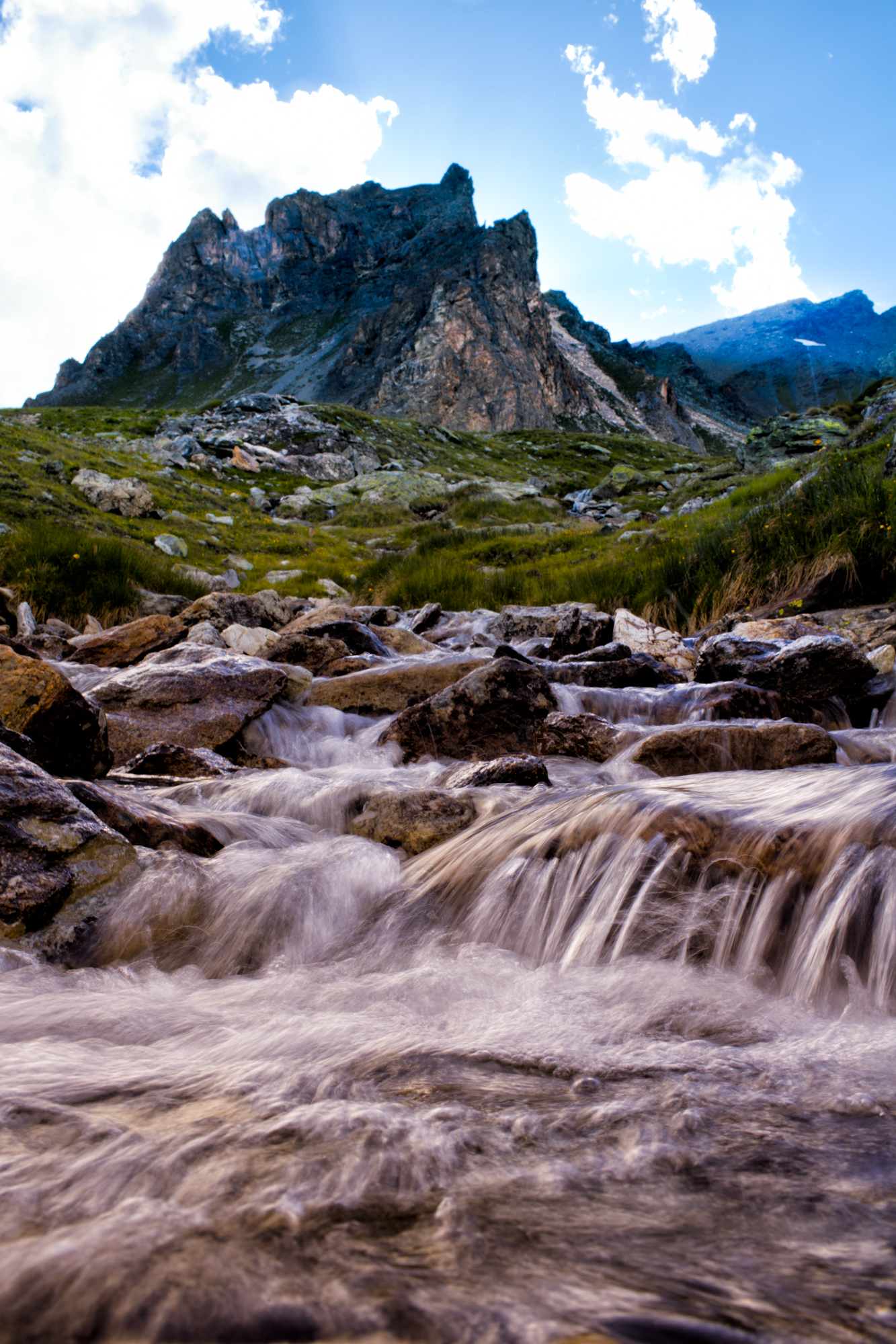
Mont Blanc de Cheilon is unmistakable; it has a near perfect edge that makes it appear a mountain cloth has been placed over a pyramid. The green pastures turn to a dusty shale carved by a river running from eastern runoff of Glacier de Cheilon.
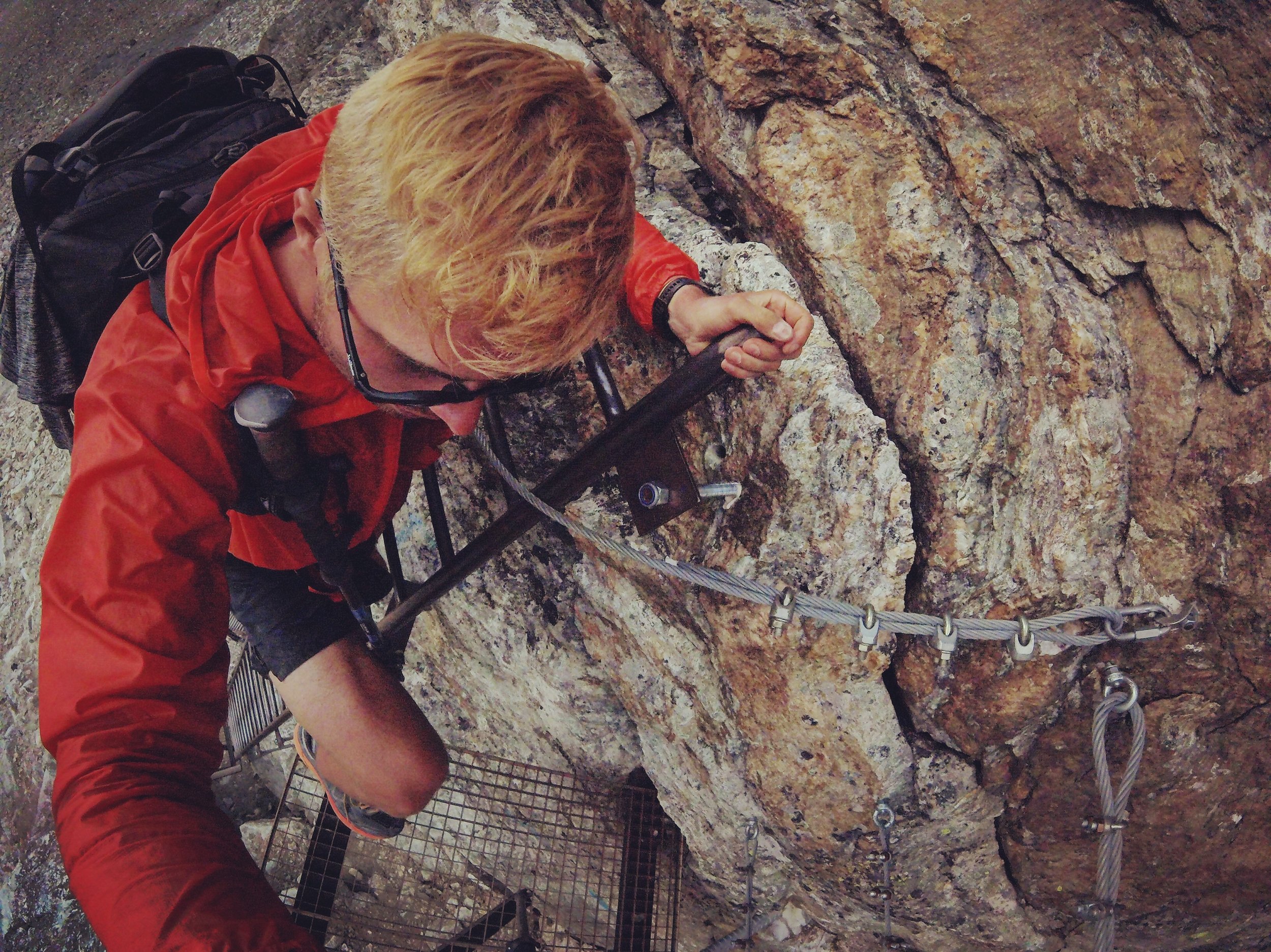
Day 5: Col du Reidmatten
After scaling an angled field of shale, the bouldered Col du Riedmatten rose forty meters to the left, and a two-story ladder through Pas de Chèvres the same distance to the right. Climbing over the col at 2,855 meters, Aiguille de la Tsa, Dent Blanche, Mont Collon, and afar glimpse of the Matterhorn spine are revealed.
Day 5: Evolène, Switzerland
The descent is a gentler grade. Greenery emerges again and the path becomes altogether less thrilling. Torrent d’Arolla flows from the north an hour west of a days end.
Day 6: Haute Route
<strikeout>Trail</strikeout>
Day 6: Arolla, Swiss
High in the Alps, shale roofed and logged walls, on the edge of a valley, in front of a snow capped mountain. You either yearn for this, or a lazy beach; the distinction—make or break.
Day 6: Mont Collon
The mammoth face of Mont Collon backdrops the Alpine hamlet of Pra Gra. Perfectly lost, in space and time.
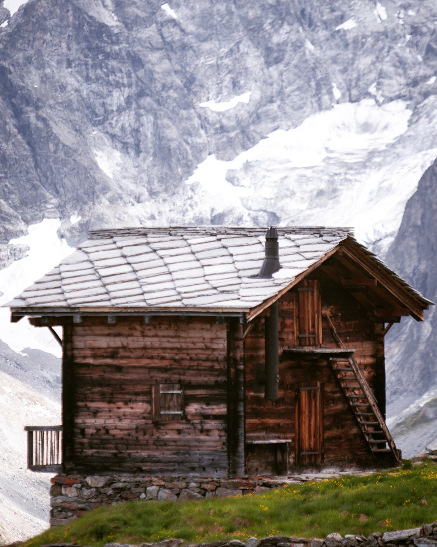
Day 6: Arolla, Swiss
Automated Light Perception System (ALPS). The case was 3D printed first on a PrintrBot, then in this orange ABS on a Dimension Elite. The internals are based on an ARM Cortex M0 processor, clocked at 48 MHz with a 2000 mAh lipoly, all sitting on a simple two layer circuit board chassis. I call the software ALPSoS, written in Arduino, open-sourced on Github; it can run multiple experimental protocols and perform statistics in-hand. The black OLED screen makes for a perfect, high contrast interface even in full sun. Light stimulation is delivered through an LED panel with ambient light levels being recorded through a front-facing photo sensor. As I’ve already found out, it’s not perfect. Evaluate, iterate, ship ship ship.
Day 6: Les Haudères, Valais, Switzerland
These royal clouds always remind me of the Tuileries; of an evening stroll along the loved locked bridges of the Seine.
Day 7: Les Haudères, Valais, Switzerland
35mm locked at f/1.4, ISO 2000. 2 AM beeps the bivy watch, for a zipper past the mesh, of the heavens beyond the pines, above the columned beasts.
Day 7: Lac Bleu, La Gouille, Arolla
Like bad questions, no such thing as wrong turns. Just above 2,000 meters it’s a dip for some and dirt for others.
Day 7: Aiguilles Rouges
Down from Cabane Aiguilles Rouges the path aims towards Dent de Perroc, Aiguille de la Tsa, La Maya…
Day 7: Arolla, Swiss
The mountains surrounding Arolla have a favorable profile; up and down. The Haute Route itself oscillates above and below the 2,500 meter mark that is called “high altitude”. Centering measurements about that line is an easy way to split the analysis, and speak in terms of the existing literature. Far down the path Mont Colon peaks again, wrapped at the toes by Glacier d’Arolla.
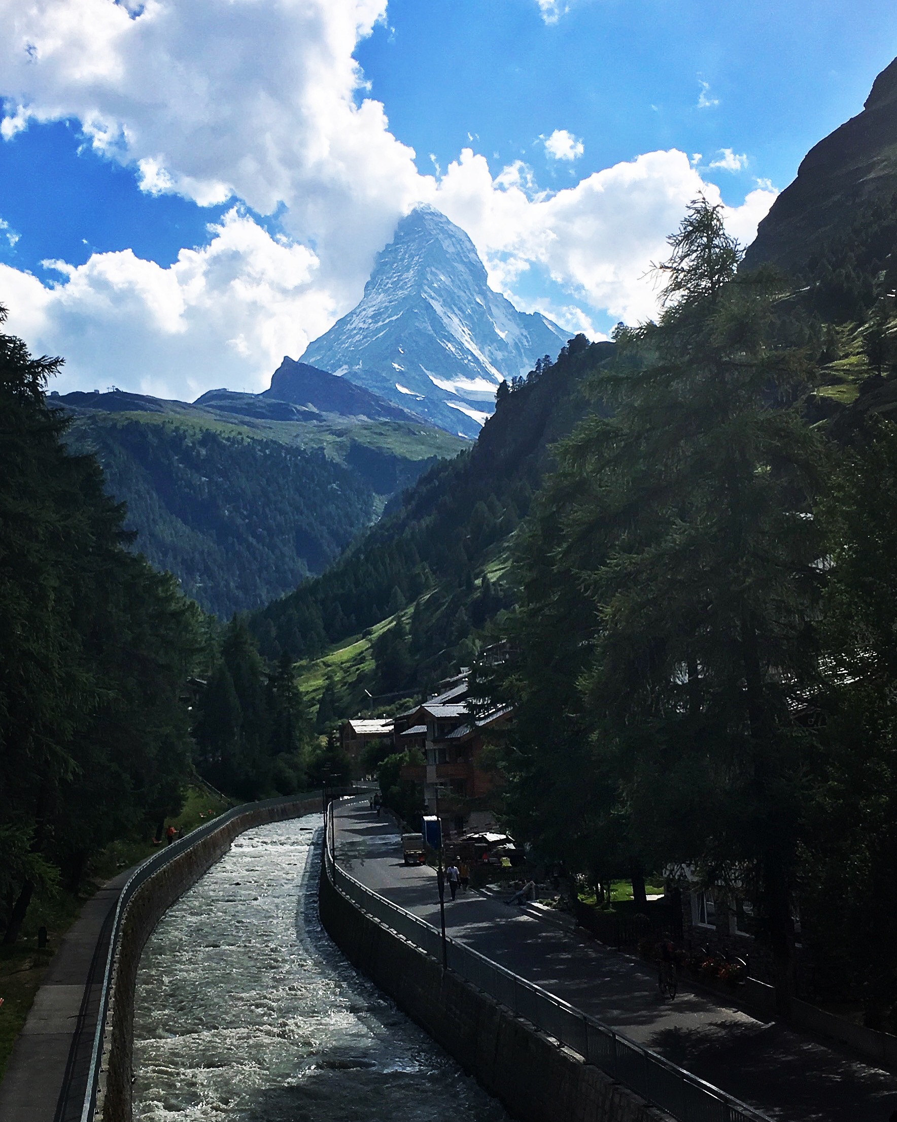
Day 7: Zermatt, Switzerland
The Matterhorn stands far beyond the Vispa River. In German, ‘Matte’ translates to ‘meadow’ and so it is a meadowed-peak. Named after its approach, not so much it’s climb, it represents the northeast precipice of this alpine adventure.
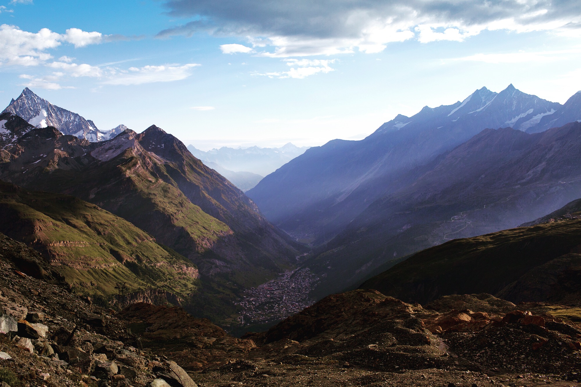
Day 8: Trockener Steg
At nearly 3,000 meters morning breaks onto Zermatt, sitting in front of Täsch in the Matter Valley. Bösentrift trails down from the right, the Äschhorn to the left.
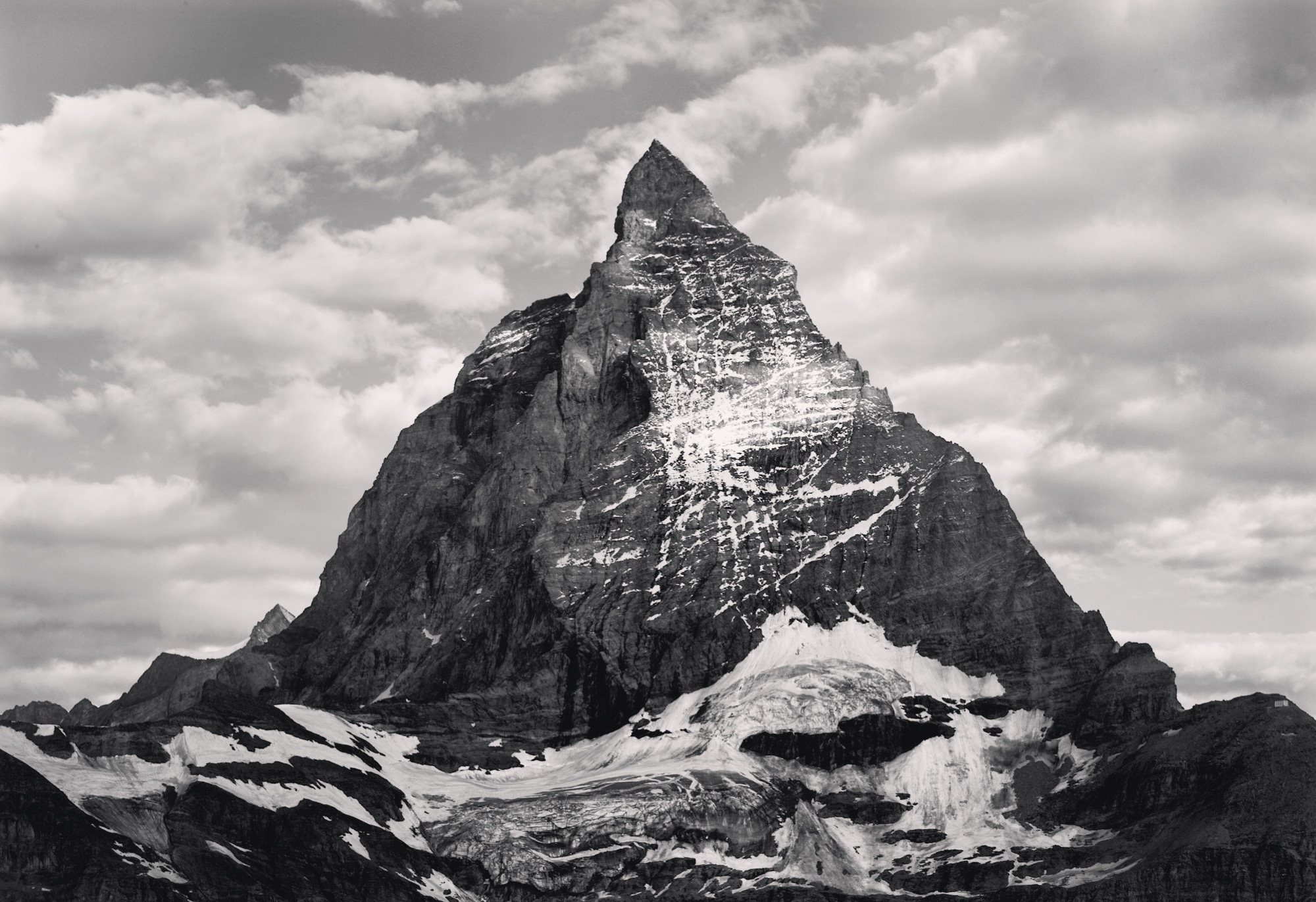
Day 8: Matterhorn
Presence, prominence, provenance. Sitting above all mountains in the lower 48, but below some base camps of the Himalaya, the Matterhorn peak takes 12th overall in Western Europe at 4,478 meters. These upcoming days 152 years ago were important to the epic, the epoch—the first ascent took place from the Swiss end July 14 with second route being conquered from the Italian side on July 17.
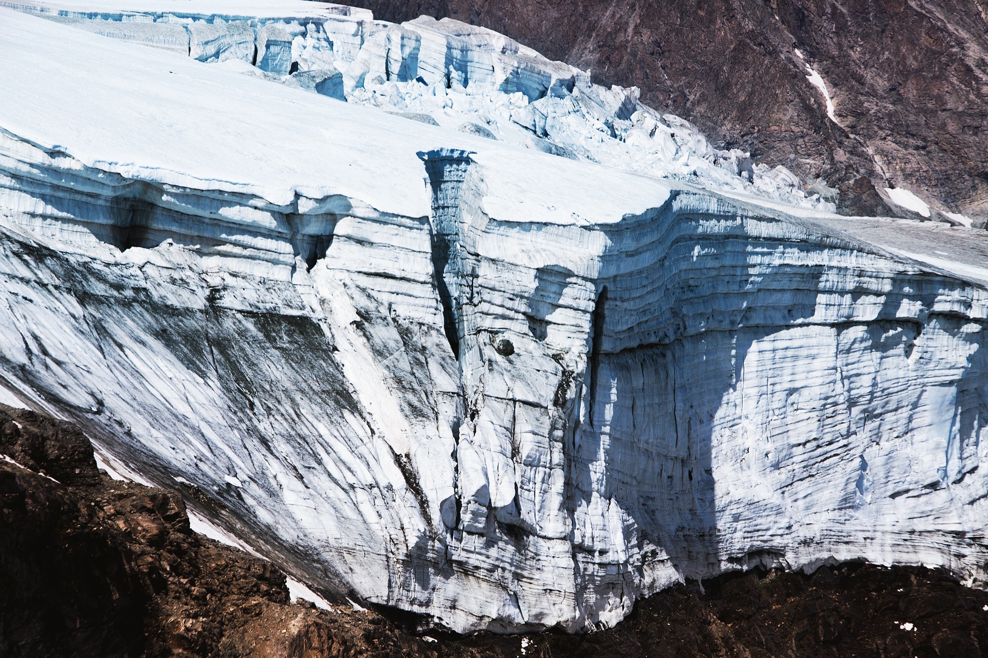
Day 8: Hörnlihütte
An extension of the Zmutt Glacier on the north side of the Matterhorn.
Day 8: Matterhorn
My last evaluation, at 3,262 meters beneath Stage 1 of the Hörnligrat route. It marks the 30th location over the 151 kilometer trek where paper and pen took down 13 unique pieces of information. Using #garmin UltraTrac, every 60 seconds of GPS, altitude, temperature and heart rate were recorded, altogether at least half a million data points. Morning assessments were the Lake Louise Score (LLS) and Chalder Fatigue Questionnaire (CFQ) which are not only subjective data, but are important in creating predefined limits that would deem a day, or remainder of an expedition a no-go due to altitude mountain sickness or exhaustion.
Day 8: Hörnlihütte
Looking the other way each the four-thousanders line a horizon. The earthly cataclysms, the human tragedies and triumphs fade together as you imagine taking their peaks on a stroll, from one to the next. To the left sits Hörnlihütte, otherwise the base camp that would begin an early morning bid for the Matterhorn summit.
Day 9: Zermatt, Switzerland
To Furi!

Day 9: Schwarzsee
Today has many butterflies, the first being the shale roof of this chalet upon Schwarzee. The layered rocks are set in butterfly formation, one of the features that defines the rustic, subtle multicolored aesthetic of Alpine architecture.
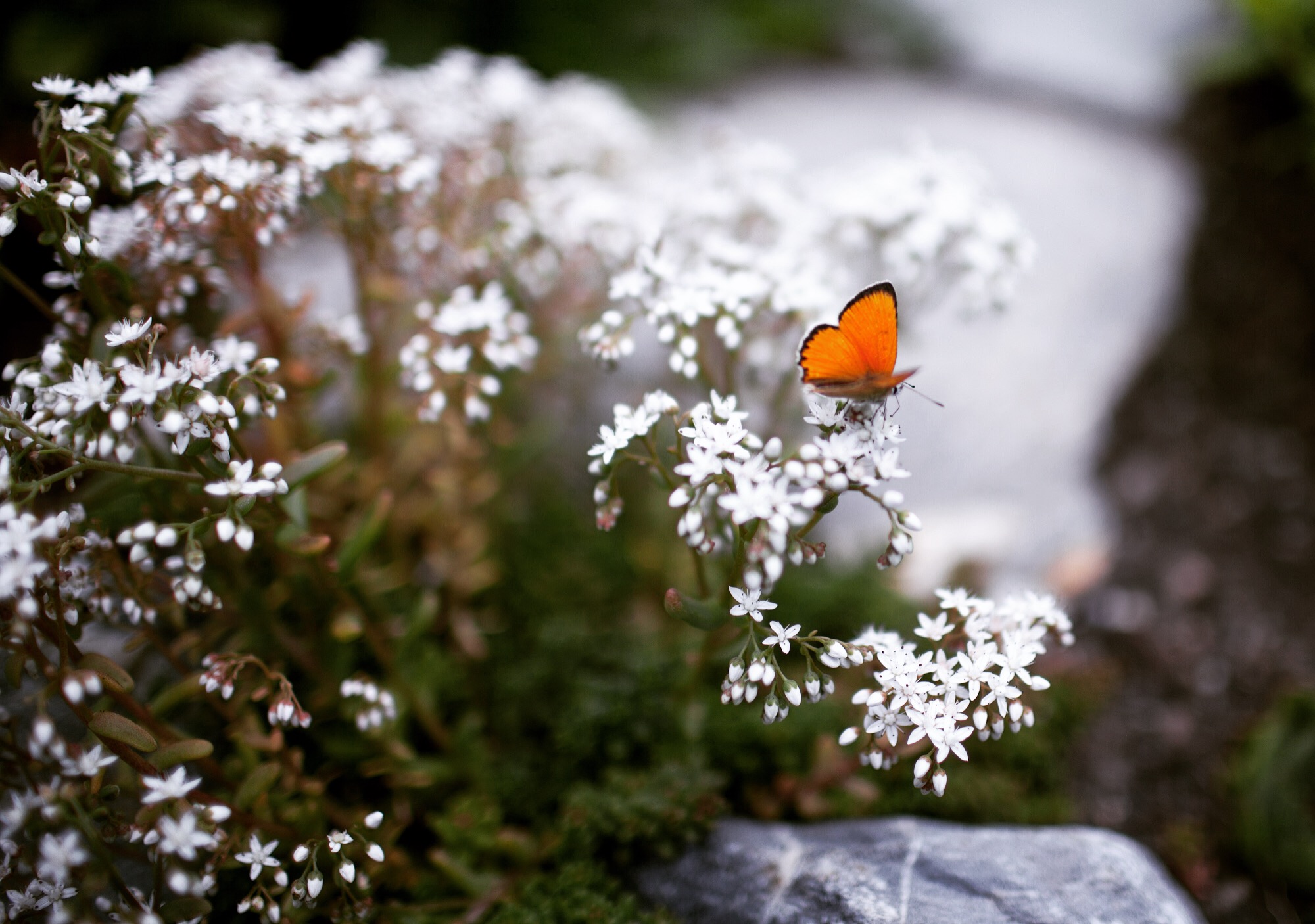
Day 9: Ricola Herb Garden / Kräutergarten
Among the peppermint and lemon balm a Lycaena dispar (large copper) butterfly rests for just a frame, then vanishes rightward in thyme.
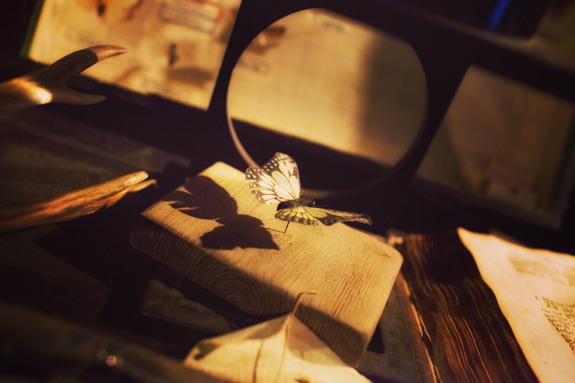
Day 9: Matterhorn Museum Zermatlantis
The unmistakable markings of the monarch, sometimes called the “wanderer” butterfly. A perfect nickname, perched on this 18th century desk of a geologist, meteorologist, naturalist… Of the few scientists that came through Zermatt before modern times, many stayed in this 3-bed guest house of the local priest. One most notable, Horace-Bénédict de Saussure, made these mountains (from Mont Blanc to the Matterhorn) the prime focus of his academic pursuits, based in Geneva. He was a pioneer in the fields of chemistry, geology, botany and this burgeoning sport called ‘mountaineering’. His four volume publication, Voyages dans les Alpes (1779-1796), undeniably spilled copious gas unto the fire that fueled Paccard and Balmat to the summit of Mont Blanc in 1786. Armed with barometers, thermometers, and sextants, Saussure pursued deep purpose in the outdoors and serves as inspiration to those wanderers—explorers—of today.
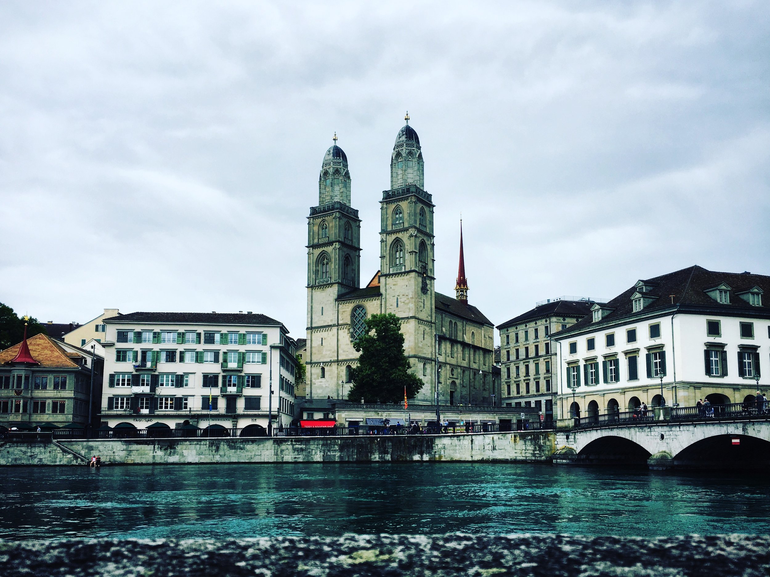
Day 10: Grossmünster
Northward rails to Zurich land upon the Limmat river, home to Grossmünster, a church said to be commissioned by Charlemagne. I was immediately thrown by the symmetry of the towers; it’s not normal for religious sites to stand so even. Typically, churches have asymmetry in their architecture, particularly in their towers. You can see this most notably in the Church of Our Lady before Týn in Prague (with towers named: Adam and Eve), and even in secular architecture like the Smithsonian Castle in Washington, D.C. The story deepens, as I found that the original north tower (photo left) was higher than its twin, made to hold the church bells and conforming to the natural style of Old Europe. By the fifteenth century the south tower was built up to match, then both originals irreversibly ruined after a fire in the late seventeen hundreds. Still today, the south and north towers differ by a few pieces; adorations, and an extra decorative lintel on the fourth block of the south tower (photo right). I once wrote a whole book on asymmetry (re: Left) with a large section devoted to this topic. Sometimes the asymmetry serves a purpose, but more often than not, it is meant to represent dichotomies (e.g. right/left, good/evil), or in the case of some eastern artifacts, the asymmetry is introduced as an error in design to represent our failing as human beings, respecting the sanctity and faultlessness of the divine.
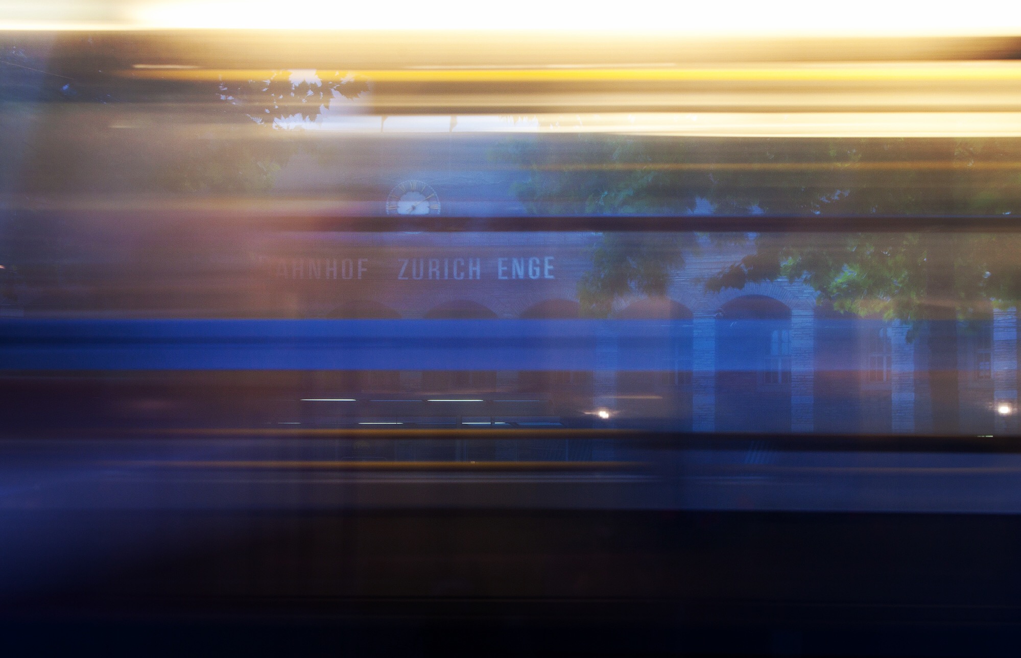
Day 10: Zürich Enge railway station
The number five tracks a semicircle in the foreground. Beyond the wet toes of a traveler reading of silk roads, thunder whispers bonne nuit, gute nacht, good night.
End: Haute Route
This trip concludes with a trending data set (r2 = 0.339, p = 0.07) indicating high altitude exposure enhances neuronal excitability, a finding contrary to existing literature relating to hypoxia. Based on this field testing I have filed a provisional patent on a method to improve ALPS using fiber optics to better target rod verse cone stimulation in the retina. I’m most excited report that I’ll be lecturing for Physiology 405/406, “Extreme Physiology,” here at Michigan this fall.
Returning home means returning to the primary question: do extreme environments offer therapies, reversible models, or insights that can help those suffering in normal environments? Is disease just another extreme environment?